Pingba geodata
Pingba (Chongqing) is a seat of a fourth-order administrative division; located in China in Asia/Shanghai (GMT+8) time zone. In our database, there are 1268 cities with bigger population. Compared to other cities in China, 61.1% of cities are located further ↓South; 78.5% of cities are located further →East and 77.2% of cities have lower elevation than Pingba. Note1


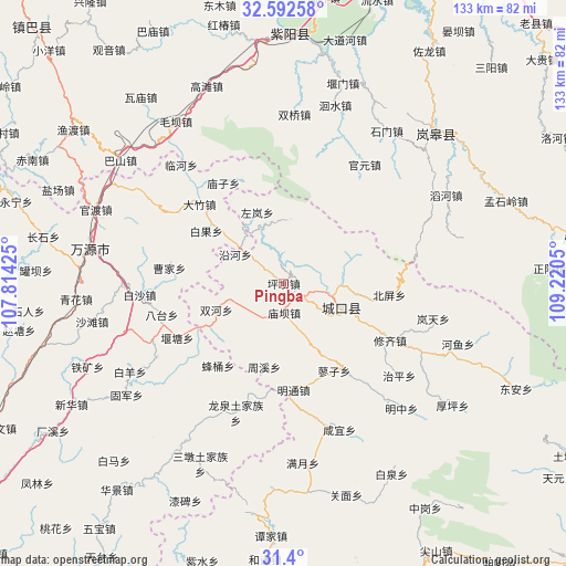
Pingba GPS coordinates[2]
31° 59' 53.628" North, 108° 31' 2.532" East
| Map corner | latitude | longitude |
|---|---|---|
| Upper-left | 32.59258°, | 107.81425° |
| Center: | 31.99823°, | 108.51737° |
| Lower-right: | 31.4°, | 109.2205° |
| Map W x H: | 132.6×132.6 km | = 82.4×82.4mi |
| max Lat: | 53.31946° ⇑38.9% North |
| Pingba: | 31.99823° |
| min Lat: | ⇓61.1% South 18.22056° |
| min Long | Pingba | max Long |
| 75.07348° | 108.51737° | 134.28917° |
| W 21.5%⇐ | ⇒78.5% E |
Elevation
Elevation of Pingba is 581 m = 1906 ft, and this is 96.2 m = 316 ft above average elevation for this country.
| Max E: |
5622 m = 18445 ft | 22.8% |
| Pingba | 581 m 1906 ft | |
| Avg. | 484.8 m = 1591 ft | |
Min E: |
-3 m = -10 ft | 77.2% |
See also: China elevation on elevation.city.
Geographical zone
Pingba is located in North temperate zone (between Tropic of Cancer and the Arctic Circle). Distance of this Northern Tropic circle is 952 km =591.5 mi to South.| Distance of | km | miles | from Pingba |
|---|---|---|---|
| North Pole | 6449.2 | 4007.3 | to North |
| Arctic Circle | 3843.3 | 2388.1 | to North |
| Tropic Cancer | 952 | 591.5 | to South |
| Equator | 3557.9 | 2210.8 | to South |


Nearby cities:
15 places around Pingba: (largest is in red/bold)
• Bashan
13.5 km =8.4 mi,  339°
339°
• Beiping
24.8 km =15.4 mi,  96°
96°
• Gaonan
15 km =9.3 mi,  359°
359°
• Gaoyan
11.9 km =7.4 mi,  125°
125°
• Gecheng
14.6 km =9.1 mi,  112°
112°
• Jiwu
32.5 km =20.2 mi,  166°
166°
• Liaozi
23.7 km =14.7 mi,  150°
150°
• Longtian
11.4 km =7.1 mi, 103°
• Miaoba
6.9 km =4.3 mi,  179°
179°
• Mingtong
25.1 km =15.6 mi, 174°
• Shuanghe
17.1 km =10.6 mi,  248°
248°
• Xiuqi
28.3 km =17.6 mi,  118°
118°
• Yanhe
13.3 km =8.3 mi,  300°
300°
• Zhouxi
20.5 km =12.7 mi,  190°
190°
• Zuolan
17.8 km =11.1 mi, 339°
Sources, notices
• [Note1] Compared only with cities in China existing in our database
• [Src1] Map data: © OpenStreetMap contributors (CC-BY-SA)
• [Src2] Other city data from geonames.org with taken over terms of usage.
• [Src3] Geographical zone / Annual Mean Temperature by Robert A. Rohde @ Wikipedia
