Pengzhai geodata
Pengzhai (Guangdong) is a seat of a fourth-order administrative division; located in China in Asia/Shanghai (GMT+8) time zone. In our database, there are 1268 cities with bigger population. Compared to other cities in China, 88.9% of cities are located further ↑North; 54.8% of cities are located further ←West and 55.4% of cities have higher elevation than Pengzhai. Note1


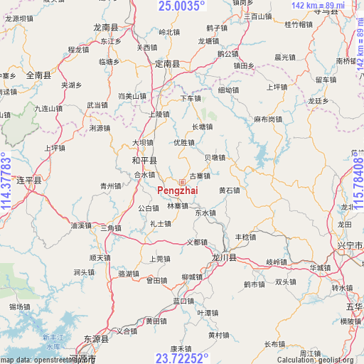
Pengzhai GPS coordinates[2]
24° 21' 52.668" North, 115° 4' 51.42" East
| Map corner | latitude | longitude |
|---|---|---|
| Upper-left | 25.0035°, | 114.37783° |
| Center: | 24.36463°, | 115.08095° |
| Lower-right: | 23.72252°, | 115.78408° |
| Map W x H: | 142.4×142.4 km | = 88.5×88.5mi |
| max Lat: | 53.31946° ⇑88.9% North |
| Pengzhai: | 24.36463° |
| min Lat: | ⇓11.1% South 18.22056° |
| min Long | Pengzhai | max Long |
| 75.07348° | 115.08095° | 134.28917° |
| W 54.8%⇐ | ⇒45.2% E |
Elevation
Elevation of Pengzhai is 129 m = 423 ft, and this is 355.8 m = 1167 ft below average elevation for this country.
| Max E: |
5622 m = 18445 ft | 55.4% |
| Avg. | 484.8 m = 1591 ft | |
| Pengzhai | 129 m = 423 ft | |
Min E: |
-3 m = -10 ft | 44.6% |
See also: China elevation on elevation.city.
Geographical zone
Pengzhai is located in North temperate zone (between Tropic of Cancer and the Arctic Circle). Distance of this Northern Tropic circle is 103.2 km =64.1 mi to South.| Distance of | km | miles | from Pengzhai |
|---|---|---|---|
| North Pole | 7298 | 4534.8 | to North |
| Arctic Circle | 4692.1 | 2915.5 | to North |
| Tropic Cancer | 103.2 | 64.1 | to South |
| Equator | 2709.1 | 1683.4 | to South |


Nearby cities:
15 places around Pengzhai: (largest is in red/bold)
• Beidun
16.7 km =10.4 mi,  52°
52°
• Changtang
22.5 km =14 mi,  16°
16°
• Chetian
22.2 km =13.8 mi,  69°
69°
• Daba
21.7 km =13.5 mi,  317°
317°
• Dongshui
15.3 km =9.5 mi,  142°
142°
• Gongbai
16 km =9.9 mi,  233°
233°
• Guzhai
7.4 km =4.6 mi, 66°
• Heshui
15.2 km =9.4 mi,  282°
282°
• Huangshi
18.6 km =11.6 mi,  98°
98°
• Linzhai
8.6 km =5.3 mi,  187°
187°
• Lishi
17.9 km =11.1 mi,  208°
208°
• Sidu
23.9 km =14.9 mi,  133°
133°
• Yangming
17.8 km =11.1 mi,  303°
303°
• Yidu
23.7 km =14.7 mi,  166°
166°
• Yousheng
16.1 km =10 mi,  2°
2°
Sources, notices
• [Note1] Compared only with cities in China existing in our database
• [Src1] Map data: © OpenStreetMap contributors (CC-BY-SA)
• [Src2] Other city data from geonames.org with taken over terms of usage.
• [Src3] Geographical zone / Annual Mean Temperature by Robert A. Rohde @ Wikipedia
