Paibu geodata
Paibu (Jiangxi) is a seat of a fourth-order administrative division; located in China in Asia/Shanghai (GMT+8) time zone. In our database, there are 1268 cities with bigger population. Compared to other cities in China, 70.3% of cities are located further ↑North; 50.1% of cities are located further ←West and 65.4% of cities have lower elevation than Paibu. Note1


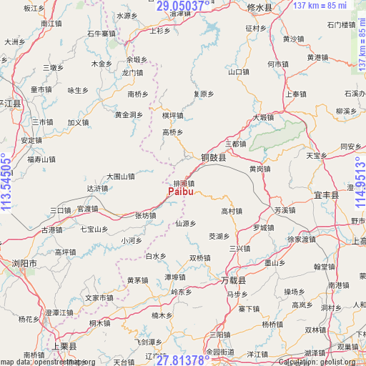
Paibu GPS coordinates[2]
28° 26' 1.968" North, 114° 14' 53.412" East
| Map corner | latitude | longitude |
|---|---|---|
| Upper-left | 29.05037°, | 113.54505° |
| Center: | 28.43388°, | 114.24817° |
| Lower-right: | 27.81378°, | 114.9513° |
| Map W x H: | 137.5×137.5 km | = 85.4×85.4mi |
| max Lat: | 53.31946° ⇑70.3% North |
| Paibu: | 28.43388° |
| min Lat: | ⇓29.7% South 18.22056° |
| min Long | Paibu | max Long |
| 75.07348° | 114.24817° | 134.28917° |
| W 50.1%⇐ | ⇒49.9% E |
Elevation
Elevation of Paibu is 333 m = 1093 ft, and this is 151.8 m = 498 ft below average elevation for this country.
| Max E: |
5622 m = 18445 ft | 34.6% |
| Avg. | 484.8 m = 1591 ft | |
| Paibu | 333 m = 1093 ft | |
Min E: |
-3 m = -10 ft | 65.4% |
See also: China elevation on elevation.city.
Geographical zone
Paibu is located in North temperate zone (between Tropic of Cancer and the Arctic Circle). Distance of this Northern Tropic circle is 555.6 km =345.2 mi to South.| Distance of | km | miles | from Paibu |
|---|---|---|---|
| North Pole | 6845.5 | 4253.6 | to North |
| Arctic Circle | 4239.6 | 2634.4 | to North |
| Tropic Cancer | 555.6 | 345.2 | to South |
| Equator | 3161.6 | 1964.5 | to South |


Nearby cities:
15 places around Paibu: (largest is in red/bold)
• Baisha
16.6 km =10.3 mi,  284°
284°
• Baishui
29.1 km =18.1 mi,  201°
201°
• Chixing
24.9 km =15.5 mi,  182°
182°
• Daweishan
23.7 km =14.7 mi, 277°
• Gaocun
20.9 km =13 mi,  119°
119°
• Gaoqiao
19.7 km =12.2 mi,  348°
348°
• Jiaohu
23.6 km =14.7 mi,  145°
145°
• Qiping
26.1 km =16.2 mi, 350°
• Sandu
24.6 km =15.3 mi,  52°
52°
• Shihuajian
29.1 km =18.1 mi,  80°
80°
• Shuangqiao
28.5 km =17.7 mi,  167°
167°
• Wenquan
15.1 km =9.4 mi,  40°
40°
• Xianyuan
15.1 km =9.4 mi, 176°
• Yongning
15.3 km =9.5 mi, 48°
• Zhangfang
18.5 km =11.5 mi,  230°
230°
Sources, notices
• [Note1] Compared only with cities in China existing in our database
• [Src1] Map data: © OpenStreetMap contributors (CC-BY-SA)
• [Src2] Other city data from geonames.org with taken over terms of usage.
• [Src3] Geographical zone / Annual Mean Temperature by Robert A. Rohde @ Wikipedia
