Cezi geodata
Cezi (Zhejiang) is a seat of a fourth-order administrative division; located in China in Asia/Shanghai (GMT+8) time zone. In our database, there are 1268 cities with bigger population. Compared to other cities in China, 53.1% of cities are located further ↑North; 91% of cities are located further ←West and 84.9% of cities have higher elevation than Cezi. Note1


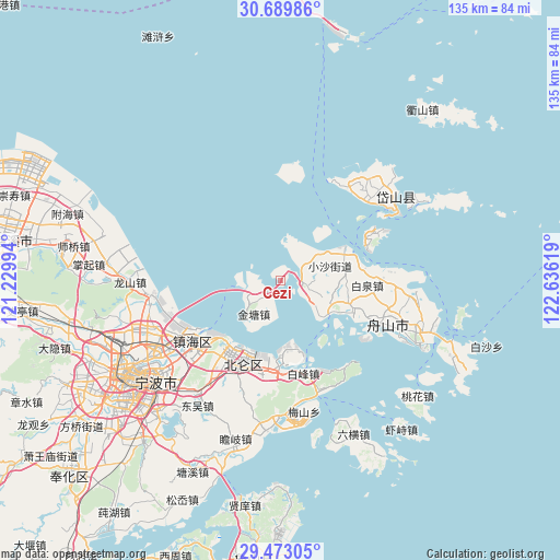
Cezi GPS coordinates[2]
30° 4' 59.988" North, 121° 55' 59.016" East
| Map corner | latitude | longitude |
|---|---|---|
| Upper-left | 30.68986°, | 121.22994° |
| Center: | 30.08333°, | 121.93306° |
| Lower-right: | 29.47305°, | 122.63619° |
| Map W x H: | 135.3×135.3 km | = 84.1×84.1mi |
| max Lat: | 53.31946° ⇑53.1% North |
| Cezi: | 30.08333° |
| min Lat: | ⇓46.9% South 18.22056° |
| min Long | Cezi | max Long |
| 75.07348° | 121.93306° | 134.28917° |
| W 91%⇐ | ⇒9% E |
Elevation
Elevation of Cezi is 16 m = 52 ft, and this is 468.8 m = 1538 ft below average elevation for this country.
| Max E: |
5622 m = 18445 ft | 84.9% |
| Avg. | 484.8 m = 1591 ft | |
| Cezi | 16 m = 52 ft | |
Min E: |
-3 m = -10 ft | 15.1% |
See also: China elevation on elevation.city.
Geographical zone
Cezi is located in North temperate zone (between Tropic of Cancer and the Arctic Circle). Distance of this Northern Tropic circle is 739 km =459.2 mi to South.| Distance of | km | miles | from Cezi |
|---|---|---|---|
| North Pole | 6662.1 | 4139.6 | to North |
| Arctic Circle | 4056.2 | 2520.4 | to North |
| Tropic Cancer | 739 | 459.2 | to South |
| Equator | 3345 | 2078.5 | to South |


Nearby cities:
15 places around Cezi: (largest is in red/bold)
• Baifeng
23.5 km =14.6 mi,  166°
166°
• Baiquan
21 km =13 mi,  93°
93°
• Beilun
20.4 km =12.7 mi,  206°
206°
• Cengang
6.1 km =3.8 mi,  96°
96°
• Chaiqiao
23.9 km =14.9 mi,  184°
184°
• Daqi
25 km =15.5 mi, 211°
• Ganlan
19.7 km =12.2 mi,  83°
83°
• Jintang
10.8 km =6.7 mi,  216°
216°
• Ma’ao
15.2 km =9.4 mi, 77°
• Shadili
14.4 km =8.9 mi,  44°
44°
• Shuangqiao
8 km =5 mi,  109°
109°
• Xiaogang
23.5 km =14.6 mi,  231°
231°
• Xiaosha
12.3 km =7.6 mi, 77°
• Xiapu
22.2 km =13.8 mi,  193°
193°
• Yancang
13.2 km =8.2 mi,  115°
115°
Sources, notices
• [Note1] Compared only with cities in China existing in our database
• [Src1] Map data: © OpenStreetMap contributors (CC-BY-SA)
• [Src2] Other city data from geonames.org with taken over terms of usage.
• [Src3] Geographical zone / Annual Mean Temperature by Robert A. Rohde @ Wikipedia
