Beilun geodata
Beilun (Zhejiang) is a seat of a third-order administrative division; located in China in Asia/Shanghai (GMT+8) time zone. In our database, there are 1268 cities with bigger population. Compared to other cities in China, 54.8% of cities are located further ↑North; 90.9% of cities are located further ←West and 98.3% of cities have higher elevation than Beilun. Note1


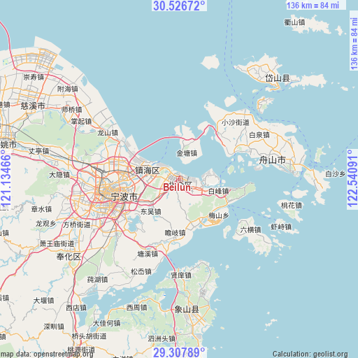
Beilun GPS coordinates[2]
29° 55' 9.012" North, 121° 50' 16.008" East
| Map corner | latitude | longitude |
|---|---|---|
| Upper-left | 30.52672°, | 121.13466° |
| Center: | 29.91917°, | 121.83778° |
| Lower-right: | 29.30789°, | 122.54091° |
| Map W x H: | 135.5×135.5 km | = 84.2×84.2mi |
| max Lat: | 53.31946° ⇑54.8% North |
| Beilun: | 29.91917° |
| min Lat: | ⇓45.2% South 18.22056° |
| min Long | Beilun | max Long |
| 75.07348° | 121.83778° | 134.28917° |
| W 90.9%⇐ | ⇒9.1% E |
Elevation
Elevation of Beilun is 4 m = 13 ft, and this is 480.8 m = 1577 ft below average elevation for this country.
| Max E: |
5622 m = 18445 ft | 98.3% |
| Avg. | 484.8 m = 1591 ft | |
| Beilun | 4 m = 13 ft | |
Min E: |
-3 m = -10 ft | 1.7% |
See also: China elevation on elevation.city.
Geographical zone
Beilun is located in North temperate zone (between Tropic of Cancer and the Arctic Circle). Distance of this Northern Tropic circle is 720.8 km =447.9 mi to South.| Distance of | km | miles | from Beilun |
|---|---|---|---|
| North Pole | 6680.4 | 4151 | to North |
| Arctic Circle | 4074.5 | 2531.8 | to North |
| Tropic Cancer | 720.8 | 447.9 | to South |
| Equator | 3326.7 | 2067.1 | to South |


Nearby cities:
15 places around Beilun: (largest is in red/bold)
• Baifeng
15.6 km =9.7 mi,  107°
107°
• Cengang
23.3 km =14.5 mi,  40°
40°
• Cezi
20.4 km =12.7 mi,  26°
26°
• Chaiqiao
9.2 km =5.7 mi,  126°
126°
• Daqi
5 km =3.1 mi,  233°
233°
• Dongwu
16.6 km =10.3 mi,  222°
222°
• Jintang
10 km =6.2 mi,  15°
15°
• Li’ao
19.8 km =12.3 mi, 132°
• Qiu’ai
21.2 km =13.2 mi,  249°
249°
• Shuangqiao
22.8 km =14.2 mi,  47°
47°
• Wuxiang
16.6 km =10.3 mi,  240°
240°
• Xiaogang
9.8 km =6.1 mi,  290°
290°
• Xiapu
5.3 km =3.3 mi, 129°
• Zhaobaoshan
15.5 km =9.6 mi, 291°
• Zhuangshi
22 km =13.7 mi,  274°
274°
Sources, notices
• [Note1] Compared only with cities in China existing in our database
• [Src1] Map data: © OpenStreetMap contributors (CC-BY-SA)
• [Src2] Other city data from geonames.org with taken over terms of usage.
• [Src3] Geographical zone / Annual Mean Temperature by Robert A. Rohde @ Wikipedia
