Meijiang geodata
Meijiang (Jiangxi) is a seat of a third-order administrative division; located in China in Asia/Shanghai (GMT+8) time zone. In our database, there are 1268 cities with bigger population. Compared to other cities in China, 80.6% of cities are located further ↑North; 60.2% of cities are located further ←West and 53.7% of cities have lower elevation than Meijiang. Note1


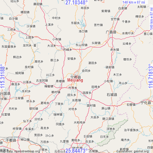
Meijiang GPS coordinates[2]
26° 28' 32.988" North, 116° 0' 54" East
| Map corner | latitude | longitude |
|---|---|---|
| Upper-left | 27.10348°, | 115.31188° |
| Center: | 26.47583°, | 116.015° |
| Lower-right: | 25.84473°, | 116.71813° |
| Map W x H: | 140×140 km | = 87×87mi |
| max Lat: | 53.31946° ⇑80.6% North |
| Meijiang: | 26.47583° |
| min Lat: | ⇓19.4% South 18.22056° |
| min Long | Meijiang | max Long |
| 75.07348° | 116.015° | 134.28917° |
| W 60.2%⇐ | ⇒39.8% E |
Elevation
Elevation of Meijiang is 195 m = 640 ft, and this is 289.8 m = 951 ft below average elevation for this country.
| Max E: |
5622 m = 18445 ft | 46.3% |
| Avg. | 484.8 m = 1591 ft | |
| Meijiang | 195 m = 640 ft | |
Min E: |
-3 m = -10 ft | 53.7% |
See also: China elevation on elevation.city.
Geographical zone
Meijiang is located in North temperate zone (between Tropic of Cancer and the Arctic Circle). Distance of this Northern Tropic circle is 337.9 km =210 mi to South.| Distance of | km | miles | from Meijiang |
|---|---|---|---|
| North Pole | 7063.2 | 4388.9 | to North |
| Arctic Circle | 4457.3 | 2769.6 | to North |
| Tropic Cancer | 337.9 | 210 | to South |
| Equator | 2943.8 | 1829.2 | to South |


Nearby cities:
15 places around Meijiang: (largest is in red/bold)
• Anfu
17.5 km =10.9 mi,  344°
344°
• Caijiang
25.2 km =15.7 mi,  307°
307°
• Changsheng
21.2 km =13.2 mi,  180°
180°
• Diaofeng
28.9 km =18 mi, 342°
• Guhou
17.2 km =10.7 mi,  146°
146°
• Huangshi
27.3 km =17 mi,  197°
197°
• Huitong
10.5 km =6.5 mi,  56°
56°
• Laicun
24.2 km =15 mi,  233°
233°
• Meiyao
27 km =16.8 mi,  251°
251°
• Qingtang
15.6 km =9.7 mi,  255°
255°
• Shishang
17.1 km =10.6 mi,  14°
14°
• Tianbu
19.7 km =12.2 mi,  117°
117°
• Xingjiang
24.3 km =15.1 mi,  273°
273°
• Zhantian
19.4 km =12.1 mi,  48°
48°
• Zhuzuo
10.5 km =6.5 mi, 199°
Sources, notices
• [Note1] Compared only with cities in China existing in our database
• [Src1] Map data: © OpenStreetMap contributors (CC-BY-SA)
• [Src2] Other city data from geonames.org with taken over terms of usage.
• [Src3] Geographical zone / Annual Mean Temperature by Robert A. Rohde @ Wikipedia
