Xingjiang geodata
Xingjiang (Jiangxi) is a seat of a fourth-order administrative division; located in China in Asia/Shanghai (GMT+8) time zone. In our database, there are 1268 cities with bigger population. Compared to other cities in China, 80.5% of cities are located further ↑North; 58.7% of cities are located further ←West and 60.9% of cities have lower elevation than Xingjiang. Note1


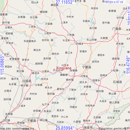
Xingjiang GPS coordinates[2]
26° 29' 27.42" North, 115° 46' 18.372" East
| Map corner | latitude | longitude |
|---|---|---|
| Upper-left | 27.11852°, | 115.06865° |
| Center: | 26.49095°, | 115.77177° |
| Lower-right: | 25.85994°, | 116.4749° |
| Map W x H: | 139.9×139.9 km | = 86.9×86.9mi |
| max Lat: | 53.31946° ⇑80.5% North |
| Xingjiang: | 26.49095° |
| min Lat: | ⇓19.5% South 18.22056° |
| min Long | Xingjiang | max Long |
| 75.07348° | 115.77177° | 134.28917° |
| W 58.7%⇐ | ⇒41.3% E |
Elevation
Elevation of Xingjiang is 269 m = 883 ft, and this is 215.8 m = 708 ft below average elevation for this country.
| Max E: |
5622 m = 18445 ft | 39.1% |
| Avg. | 484.8 m = 1591 ft | |
| Xingjiang | 269 m = 883 ft | |
Min E: |
-3 m = -10 ft | 60.9% |
See also: China elevation on elevation.city.
Geographical zone
Xingjiang is located in North temperate zone (between Tropic of Cancer and the Arctic Circle). Distance of this Northern Tropic circle is 339.6 km =211 mi to South.| Distance of | km | miles | from Xingjiang |
|---|---|---|---|
| North Pole | 7061.5 | 4387.8 | to North |
| Arctic Circle | 4455.7 | 2768.6 | to North |
| Tropic Cancer | 339.6 | 211 | to South |
| Equator | 2945.5 | 1830.2 | to South |


Nearby cities:
15 places around Xingjiang: (largest is in red/bold)
• Anfu
24.8 km =15.4 mi,  52°
52°
• Caijiang
14.3 km =8.9 mi,  16°
16°
• Dingbei
27 km =16.8 mi,  162°
162°
• Dongcun
26.1 km =16.2 mi,  236°
236°
• Ge’ao
25.9 km =16.1 mi,  190°
190°
• Gulonggang
8.9 km =5.5 mi, 237°
• Huangbei
23.7 km =14.7 mi, 18°
• Junbu
26 km =16.2 mi,  336°
336°
• Laicun
16.7 km =10.4 mi, 163°
• Liangcun
20.9 km =13 mi,  291°
291°
• Meijiang
24.3 km =15.1 mi,  93°
93°
• Meiyao
10.4 km =6.5 mi, 187°
• Nankeng
16.2 km =10.1 mi,  320°
320°
• Qingtang
10.7 km =6.6 mi,  121°
121°
• Zhuzuo
23.7 km =14.7 mi, 119°
Sources, notices
• [Note1] Compared only with cities in China existing in our database
• [Src1] Map data: © OpenStreetMap contributors (CC-BY-SA)
• [Src2] Other city data from geonames.org with taken over terms of usage.
• [Src3] Geographical zone / Annual Mean Temperature by Robert A. Rohde @ Wikipedia
