Tianbu geodata
Tianbu (Jiangxi) is a seat of a fourth-order administrative division; located in China in Asia/Shanghai (GMT+8) time zone. In our database, there are 1268 cities with bigger population. Compared to other cities in China, 80.8% of cities are located further ↑North; 61.1% of cities are located further ←West and 59.1% of cities have lower elevation than Tianbu. Note1


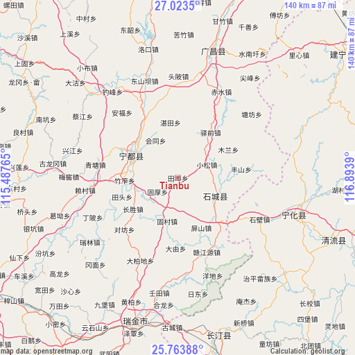
Tianbu GPS coordinates[2]
26° 23' 43.476" North, 116° 11' 26.772" East
| Map corner | latitude | longitude |
|---|---|---|
| Upper-left | 27.0235°, | 115.48765° |
| Center: | 26.39541°, | 116.19077° |
| Lower-right: | 25.76388°, | 116.8939° |
| Map W x H: | 140.1×140.1 km | = 87.1×87.1mi |
| max Lat: | 53.31946° ⇑80.8% North |
| Tianbu: | 26.39541° |
| min Lat: | ⇓19.2% South 18.22056° |
| min Long | Tianbu | max Long |
| 75.07348° | 116.19077° | 134.28917° |
| W 61.1%⇐ | ⇒38.9% E |
Elevation
Elevation of Tianbu is 248 m = 814 ft, and this is 236.8 m = 777 ft below average elevation for this country.
| Max E: |
5622 m = 18445 ft | 40.9% |
| Avg. | 484.8 m = 1591 ft | |
| Tianbu | 248 m = 814 ft | |
Min E: |
-3 m = -10 ft | 59.1% |
See also: China elevation on elevation.city.
Geographical zone
Tianbu is located in North temperate zone (between Tropic of Cancer and the Arctic Circle). Distance of this Northern Tropic circle is 329 km =204.4 mi to South.| Distance of | km | miles | from Tianbu |
|---|---|---|---|
| North Pole | 7072.2 | 4394.5 | to North |
| Arctic Circle | 4466.3 | 2775.2 | to North |
| Tropic Cancer | 329 | 204.4 | to South |
| Equator | 2934.9 | 1823.7 | to South |


Nearby cities:
15 places around Tianbu: (largest is in red/bold)
• Changsheng
21.6 km =13.4 mi,  235°
235°
• Dayou
27.9 km =17.3 mi,  181°
181°
• Fengshan
25.1 km =15.6 mi,  81°
81°
• Gucun
17.6 km =10.9 mi,  193°
193°
• Guhou
9.7 km =6 mi, 235°
• Huitong
17.2 km =10.7 mi,  329°
329°
• Meijiang
19.7 km =12.2 mi,  297°
297°
• Mulan
22.8 km =14.2 mi,  60°
60°
• Pingshan
21.8 km =13.5 mi,  154°
154°
• Qinjiang
16.1 km =10 mi,  116°
116°
• Xiaosong
12.6 km =7.8 mi,  65°
65°
• Yiqian
22.1 km =13.7 mi,  35°
35°
• Zhantian
22.1 km =13.7 mi,  352°
352°
• Zhukeng
26.2 km =16.3 mi,  139°
139°
• Zhuzuo
21 km =13 mi,  267°
267°
Sources, notices
• [Note1] Compared only with cities in China existing in our database
• [Src1] Map data: © OpenStreetMap contributors (CC-BY-SA)
• [Src2] Other city data from geonames.org with taken over terms of usage.
• [Src3] Geographical zone / Annual Mean Temperature by Robert A. Rohde @ Wikipedia
