Louzhuang geodata
Louzhuang (Jiangsu) is a seat of a fourth-order administrative division; located in China in Asia/Shanghai (GMT+8) time zone. In our database, there are 1268 cities with bigger population. Compared to other cities in China, 64.3% of cities are located further ↓South; 83.3% of cities are located further ←West and 98.3% of cities have higher elevation than Louzhuang. Note1


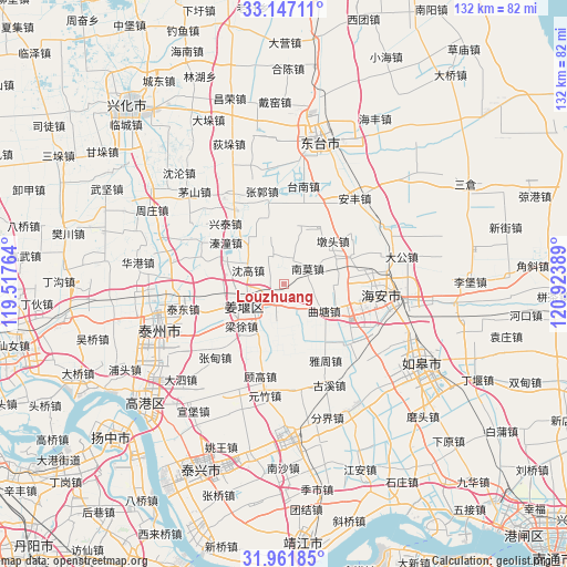
Louzhuang GPS coordinates[2]
32° 33' 23.184" North, 120° 13' 14.736" East
| Map corner | latitude | longitude |
|---|---|---|
| Upper-left | 33.14711°, | 119.51764° |
| Center: | 32.55644°, | 120.22076° |
| Lower-right: | 31.96185°, | 120.92389° |
| Map W x H: | 131.8×131.8 km | = 81.9×81.9mi |
| max Lat: | 53.31946° ⇑35.7% North |
| Louzhuang: | 32.55644° |
| min Lat: | ⇓64.3% South 18.22056° |
| min Long | Louzhuang | max Long |
| 75.07348° | 120.22076° | 134.28917° |
| W 83.3%⇐ | ⇒16.7% E |
Elevation
Elevation of Louzhuang is 4 m = 13 ft, and this is 480.8 m = 1577 ft below average elevation for this country.
| Max E: |
5622 m = 18445 ft | 98.3% |
| Avg. | 484.8 m = 1591 ft | |
| Louzhuang | 4 m = 13 ft | |
Min E: |
-3 m = -10 ft | 1.7% |
See also: China elevation on elevation.city.
Geographical zone
Louzhuang is located in North temperate zone (between Tropic of Cancer and the Arctic Circle). Distance of this Northern Tropic circle is 1014 km =630.1 mi to South.| Distance of | km | miles | from Louzhuang |
|---|---|---|---|
| North Pole | 6387.1 | 3968.8 | to North |
| Arctic Circle | 3781.2 | 2349.5 | to North |
| Tropic Cancer | 1014 | 630.1 | to South |
| Equator | 3619.9 | 2249.3 | to South |


Nearby cities:
15 places around Louzhuang: (largest is in red/bold)
• Baidian
13.2 km =8.2 mi,  14°
14°
• Baimi
6.3 km =3.9 mi,  152°
152°
• Dalun
12.7 km =7.9 mi,  171°
171°
• Duntou
15.6 km =9.7 mi,  49°
49°
• Hougang
14.8 km =9.2 mi, 12°
• Huji
15.9 km =9.9 mi,  106°
106°
• Jiangyan
9.2 km =5.7 mi,  232°
232°
• Liangxu
13.9 km =8.6 mi, 226°
• Nanmo
6.8 km =4.2 mi, 50°
• Qiaotou
14.2 km =8.8 mi,  267°
267°
• Qintong
15.9 km =9.9 mi,  310°
310°
• Qutang
12 km =7.5 mi,  123°
123°
• Shengao
8.8 km =5.5 mi,  291°
291°
• Shiyan
18.8 km =11.7 mi,  349°
349°
• Zhendong
12.2 km =7.6 mi,  328°
328°
Sources, notices
• [Note1] Compared only with cities in China existing in our database
• [Src1] Map data: © OpenStreetMap contributors (CC-BY-SA)
• [Src2] Other city data from geonames.org with taken over terms of usage.
• [Src3] Geographical zone / Annual Mean Temperature by Robert A. Rohde @ Wikipedia
