Longxian Chengguanzhen geodata
Longxian Chengguanzhen (Shaanxi) is a seat of a third-order administrative division; located in China in Asia/Shanghai (GMT+8) time zone. In our database, there are 1268 cities with bigger population. Compared to other cities in China, 74.7% of cities are located further ↓South; 84.1% of cities are located further →East and 84.8% of cities have lower elevation than Longxian Chengguanzhen. Note1
Current local time in Longxian Chengguanzhen:
05:58 PM, TuesdayDifference from your time zone: hours


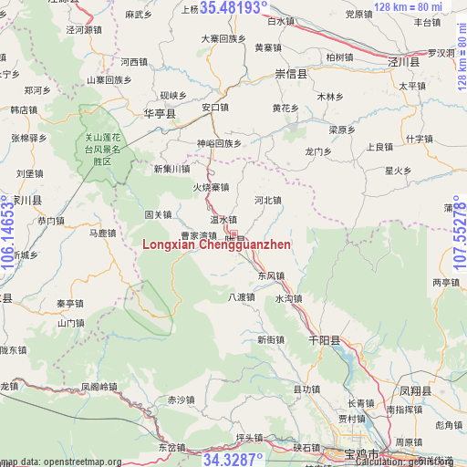
Longxian Chengguanzhen GPS coordinates[2]
34° 54' 26.424" North, 106° 50' 58.74" East
| Map corner | latitude | longitude |
|---|---|---|
| Upper-left | 35.48193°, | 106.14653° |
| Center: | 34.90734°, | 106.84965° |
| Lower-right: | 34.3287°, | 107.55278° |
| Map W x H: | 128.2×128.2 km | = 79.7×79.7mi |
| max Lat: | 53.31946° ⇑25.3% North |
| Longxian Chengguanzhen: | 34.90734° |
| min Lat: | ⇓74.7% South 18.22056° |
| min Long | Longxian Chengg | max Long |
| 75.07348° | 106.84965° | 134.28917° |
| W 15.9%⇐ | ⇒84.1% E |
Elevation
Elevation of Longxian Chengguanzhen is 973 m = 3192 ft, and this is 488.2 m = 1602 ft above average elevation for this country.
| Max E: |
5622 m = 18445 ft | 15.2% |
| Longxian Chengguanzhen | 973 m 3192 ft | |
| Avg. | 484.8 m = 1591 ft | |
Min E: |
-3 m = -10 ft | 84.8% |
See also: China elevation on elevation.city.
Geographical zone
Longxian Chengguanzhen is located in North temperate zone (between Tropic of Cancer and the Arctic Circle). Distance of this Northern Tropic circle is 1275.4 km =792.5 mi to South.| Distance of | km | miles | from Longxian Chengguanzhen |
|---|---|---|---|
| North Pole | 6125.7 | 3806.3 | to North |
| Arctic Circle | 3519.8 | 2187.1 | to North |
| Tropic Cancer | 1275.4 | 792.5 | to South |
| Equator | 3881.3 | 2411.7 | to South |


Nearby cities:
15 places around Longxian Chengguanzhen: (largest is in red/bold)
• Ankou
35.4 km =22 mi,  351°
351°
• Caobi
23.3 km =14.5 mi,  135°
135°
• Cuijiatou
46.1 km =28.6 mi,  130°
130°
• Donghua
38.6 km =24 mi,  332°
332°
• Gaoya
42.4 km =26.3 mi,  91°
91°
• Koujiahe
28.7 km =17.8 mi, 136°
• Nanzhai
40.6 km =25.2 mi, 133°
• Qianyang Chengguanzhen
39.1 km =24.3 mi, 139°
• Shajia’ao
43.5 km =27 mi, 126°
• Shigou
29.9 km =18.6 mi, 141°
• Shuangbaiyang
40.6 km =25.2 mi,  155°
155°
• Shuigou
23.1 km =14.4 mi, 139°
• Wenjiapo
35.3 km =21.9 mi, 132°
• Xiangong
46.8 km =29.1 mi,  154°
154°
• Zhangjiayuan
32.6 km =20.3 mi, 135°
Sources, notices
• [Note1] Compared only with cities in China existing in our database
• [Src1] Map data: © OpenStreetMap contributors (CC-BY-SA)
• [Src2] Other city data from geonames.org with taken over terms of usage.
• [Src3] Geographical zone / Annual Mean Temperature by Robert A. Rohde @ Wikipedia
