Ankou geodata
Ankou (Gansu) is a seat of a fourth-order administrative division; located in China in Asia/Shanghai (GMT+8) time zone. In our database, there are 1268 cities with bigger population. Compared to other cities in China, 75.5% of cities are located further ↓South; 84.3% of cities are located further →East and 89.4% of cities have lower elevation than Ankou. Note1


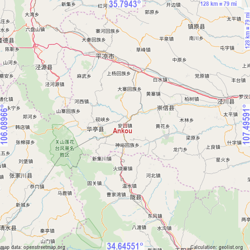
Ankou GPS coordinates[2]
35° 13' 18.984" North, 106° 47' 34.008" East
| Map corner | latitude | longitude |
|---|---|---|
| Upper-left | 35.7943°, | 106.08966° |
| Center: | 35.22194°, | 106.79278° |
| Lower-right: | 34.64551°, | 107.49591° |
| Map W x H: | 127.7×127.7 km | = 79.3×79.3mi |
| max Lat: | 53.31946° ⇑24.5% North |
| Ankou: | 35.22194° |
| min Lat: | ⇓75.5% South 18.22056° |
| min Long | Ankou | max Long |
| 75.07348° | 106.79278° | 134.28917° |
| W 15.7%⇐ | ⇒84.3% E |
Elevation
Elevation of Ankou is 1302 m = 4272 ft, and this is 817.2 m = 2681 ft above average elevation for this country.
| Max E: |
5622 m = 18445 ft | 10.6% |
| Ankou | 1302 m 4272 ft | |
| Avg. | 484.8 m = 1591 ft | |
Min E: |
-3 m = -10 ft | 89.4% |
See also: China elevation on elevation.city.
Geographical zone
Ankou is located in North temperate zone (between Tropic of Cancer and the Arctic Circle). Distance of this Northern Tropic circle is 1310.4 km =814.2 mi to South.| Distance of | km | miles | from Ankou |
|---|---|---|---|
| North Pole | 6090.7 | 3784.6 | to North |
| Arctic Circle | 3484.9 | 2165.4 | to North |
| Tropic Cancer | 1310.4 | 814.2 | to South |
| Equator | 3916.3 | 2433.5 | to South |


Nearby cities:
15 places around Ankou: (largest is in red/bold)
• Caobi
55.9 km =34.7 mi,  157°
157°
• Donghua
12.7 km =7.9 mi,  266°
266°
• Gaoya
59.7 km =37.1 mi,  127°
127°
• Honghe
61.1 km =38 mi,  352°
352°
• Jingchuan Chengguanzhen
53 km =32.9 mi,  76°
76°
• Jinping
23.8 km =14.8 mi,  64°
64°
• Koujiahe
61.2 km =38 mi, 156°
• Longxian Chengguanzhen
35.4 km =22 mi,  171°
171°
• Pingliang
36.6 km =22.7 mi,  344°
344°
• Shigou
63.1 km =39.2 mi, 157°
• Shuigou
56.3 km =35 mi, 159°
• Xiangshui
50.6 km =31.4 mi,  304°
304°
• Xingsheng
48.8 km =30.3 mi, 301°
• Zhangjiachuan
59.2 km =36.8 mi,  243°
243°
• Zhenyuan Chengguanzhen
62.5 km =38.8 mi,  35°
35°
Sources, notices
• [Note1] Compared only with cities in China existing in our database
• [Src1] Map data: © OpenStreetMap contributors (CC-BY-SA)
• [Src2] Other city data from geonames.org with taken over terms of usage.
• [Src3] Geographical zone / Annual Mean Temperature by Robert A. Rohde @ Wikipedia
