Longtan geodata
Longtan (Chongqing) is a seat of a fourth-order administrative division; located in China in Asia/Shanghai (GMT+8) time zone. In our database, there are 1268 cities with bigger population. Compared to other cities in China, 67.4% of cities are located further ↑North; 76.4% of cities are located further →East and 65.1% of cities have lower elevation than Longtan. Note1


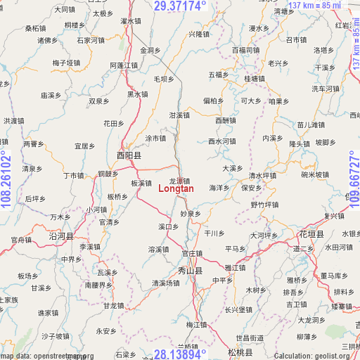
Longtan GPS coordinates[2]
28° 45' 25.776" North, 108° 57' 50.904" East
| Map corner | latitude | longitude |
|---|---|---|
| Upper-left | 29.37174°, | 108.26102° |
| Center: | 28.75716°, | 108.96414° |
| Lower-right: | 28.13894°, | 109.66727° |
| Map W x H: | 137.1×137.1 km | = 85.2×85.2mi |
| max Lat: | 53.31946° ⇑67.4% North |
| Longtan: | 28.75716° |
| min Lat: | ⇓32.6% South 18.22056° |
| min Long | Longtan | max Long |
| 75.07348° | 108.96414° | 134.28917° |
| W 23.6%⇐ | ⇒76.4% E |
Elevation
Elevation of Longtan is 328 m = 1076 ft, and this is 156.8 m = 514 ft below average elevation for this country.
| Max E: |
5622 m = 18445 ft | 34.9% |
| Avg. | 484.8 m = 1591 ft | |
| Longtan | 328 m = 1076 ft | |
Min E: |
-3 m = -10 ft | 65.1% |
See also: China elevation on elevation.city.
Geographical zone
Longtan is located in North temperate zone (between Tropic of Cancer and the Arctic Circle). Distance of this Northern Tropic circle is 591.6 km =367.6 mi to South.| Distance of | km | miles | from Longtan |
|---|---|---|---|
| North Pole | 6809.6 | 4231.3 | to North |
| Arctic Circle | 4203.7 | 2612.1 | to North |
| Tropic Cancer | 591.6 | 367.6 | to South |
| Equator | 3197.5 | 1986.8 | to South |


Nearby cities:
15 places around Longtan: (largest is in red/bold)
• Banxi
14.6 km =9.1 mi,  259°
259°
• Daxi
20.5 km =12.7 mi,  75°
75°
• Haiyang
15.7 km =9.8 mi,  98°
98°
• Houxi
21.9 km =13.6 mi,  46°
46°
• Jiangfeng
14 km =8.7 mi,  194°
194°
• Liren
22.6 km =14 mi,  111°
111°
• Longchi
18.3 km =11.4 mi,  153°
153°
• Mawang
15.2 km =9.4 mi,  355°
355°
• Miaoquan
13.6 km =8.5 mi,  163°
163°
• Shidi
22.2 km =13.8 mi,  91°
91°
• Songnong
16.4 km =10.2 mi,  123°
123°
• Tushi
20.2 km =12.6 mi,  332°
332°
• Xikou
18 km =11.2 mi, 194°
• Yongdong
22.4 km =13.9 mi,  136°
136°
• Zhongduo
21.9 km =13.6 mi,  297°
297°
Sources, notices
• [Note1] Compared only with cities in China existing in our database
• [Src1] Map data: © OpenStreetMap contributors (CC-BY-SA)
• [Src2] Other city data from geonames.org with taken over terms of usage.
• [Src3] Geographical zone / Annual Mean Temperature by Robert A. Rohde @ Wikipedia
