Miaoquan geodata
Miaoquan (Chongqing) is a seat of a fourth-order administrative division; located in China in Asia/Shanghai (GMT+8) time zone. In our database, there are 1268 cities with bigger population. Compared to other cities in China, 68.5% of cities are located further ↑North; 76.3% of cities are located further →East and 62.7% of cities have lower elevation than Miaoquan. Note1


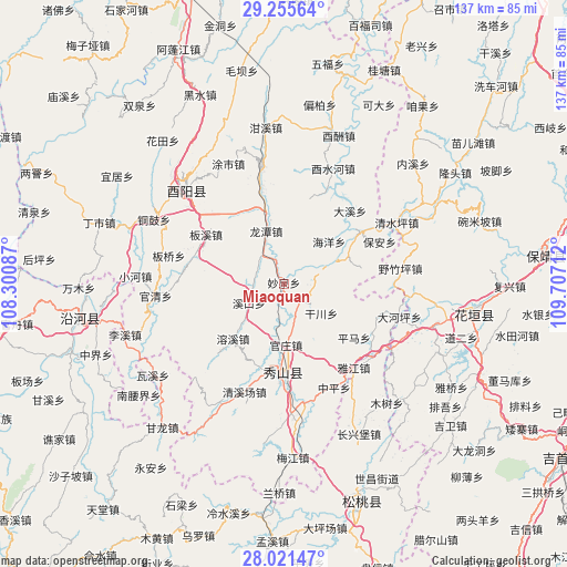
Miaoquan GPS coordinates[2]
28° 38' 25.332" North, 109° 0' 14.364" East
| Map corner | latitude | longitude |
|---|---|---|
| Upper-left | 29.25564°, | 108.30087° |
| Center: | 28.64037°, | 109.00399° |
| Lower-right: | 28.02147°, | 109.70712° |
| Map W x H: | 137.2×137.2 km | = 85.3×85.3mi |
| max Lat: | 53.31946° ⇑68.5% North |
| Miaoquan: | 28.64037° |
| min Lat: | ⇓31.5% South 18.22056° |
| min Long | Miaoquan | max Long |
| 75.07348° | 109.00399° | 134.28917° |
| W 23.7%⇐ | ⇒76.3% E |
Elevation
Elevation of Miaoquan is 292 m = 958 ft, and this is 192.8 m = 633 ft below average elevation for this country.
| Max E: |
5622 m = 18445 ft | 37.3% |
| Avg. | 484.8 m = 1591 ft | |
| Miaoquan | 292 m = 958 ft | |
Min E: |
-3 m = -10 ft | 62.7% |
See also: China elevation on elevation.city.
Geographical zone
Miaoquan is located in North temperate zone (between Tropic of Cancer and the Arctic Circle). Distance of this Northern Tropic circle is 578.6 km =359.5 mi to South.| Distance of | km | miles | from Miaoquan |
|---|---|---|---|
| North Pole | 6822.6 | 4239.4 | to North |
| Arctic Circle | 4216.7 | 2620.1 | to North |
| Tropic Cancer | 578.6 | 359.5 | to South |
| Equator | 3184.5 | 1978.8 | to South |


Nearby cities:
15 places around Miaoquan: (largest is in red/bold)
• Banxi
21 km =13 mi,  299°
299°
• Ganchuan
11.5 km =7.1 mi,  127°
127°
• Guanzhuang
14.8 km =9.2 mi,  177°
177°
• Haiyang
15.8 km =9.8 mi,  47°
47°
• Jiangfeng
7.4 km =4.6 mi,  265°
265°
• Liren
17.8 km =11.1 mi,  74°
74°
• Longchi
5.6 km =3.5 mi, 127°
• Longtan
13.6 km =8.5 mi,  343°
343°
• Pingma
21.5 km =13.4 mi, 126°
• Rongxi
17.6 km =10.9 mi,  223°
223°
• Shidi
22.2 km =13.8 mi,  55°
55°
• Songnong
10.6 km =6.6 mi, 68°
• Xikou
9.4 km =5.8 mi,  242°
242°
• Yongdong
12 km =7.5 mi,  105°
105°
• Zhonghe
21.2 km =13.2 mi, 183°
Sources, notices
• [Note1] Compared only with cities in China existing in our database
• [Src1] Map data: © OpenStreetMap contributors (CC-BY-SA)
• [Src2] Other city data from geonames.org with taken over terms of usage.
• [Src3] Geographical zone / Annual Mean Temperature by Robert A. Rohde @ Wikipedia
