Longcheng geodata
Longcheng (Guangdong) is a seat of a fourth-order administrative division; located in China in Asia/Shanghai (GMT+8) time zone. In our database, there are 1268 cities with bigger population. Compared to other cities in China, 91.2% of cities are located further ↑North; 50.1% of cities are located further ←West and 65.3% of cities have higher elevation than Longcheng. Note1


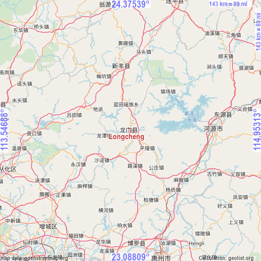
Longcheng GPS coordinates[2]
23° 43' 59.988" North, 114° 15' 0" East
| Map corner | latitude | longitude |
|---|---|---|
| Upper-left | 24.37539°, | 113.54688° |
| Center: | 23.73333°, | 114.25° |
| Lower-right: | 23.08809°, | 114.95313° |
| Map W x H: | 143.1×143.1 km | = 88.9×88.9mi |
| max Lat: | 53.31946° ⇑91.2% North |
| Longcheng: | 23.73333° |
| min Lat: | ⇓8.8% South 18.22056° |
| min Long | Longcheng | max Long |
| 75.07348° | 114.25° | 134.28917° |
| W 50.1%⇐ | ⇒49.9% E |
Elevation
Elevation of Longcheng is 71 m = 233 ft, and this is 413.8 m = 1358 ft below average elevation for this country.
| Max E: |
5622 m = 18445 ft | 65.3% |
| Avg. | 484.8 m = 1591 ft | |
| Longcheng | 71 m = 233 ft | |
Min E: |
-3 m = -10 ft | 34.7% |
See also: China elevation on elevation.city.
Geographical zone
Longcheng is located in North temperate zone (between Tropic of Cancer and the Arctic Circle). Distance of this Northern Tropic circle is 33 km =20.5 mi to South.| Distance of | km | miles | from Longcheng |
|---|---|---|---|
| North Pole | 7368.2 | 4578.4 | to North |
| Arctic Circle | 4762.3 | 2959.2 | to North |
| Tropic Cancer | 33 | 20.5 | to South |
| Equator | 2638.9 | 1639.7 | to South |


Nearby cities:
15 places around Longcheng: (largest is in red/bold)
• Dipa
21.4 km =13.3 mi,  306°
306°
• Gongzhuang
26 km =16.2 mi,  149°
149°
• Lantian
14.6 km =9.1 mi,  350°
350°
• Longhua
14.6 km =9.1 mi,  202°
202°
• Longjiang
15.3 km =9.5 mi,  161°
161°
• Longtan
14.8 km =9.2 mi,  261°
261°
• Longtian
1.9 km =1.2 mi,  359°
359°
• Luxi
19.1 km =11.9 mi,  172°
172°
• Lütian
32.3 km =20.1 mi,  285°
285°
• Pingling
13.2 km =8.2 mi,  133°
133°
• Shajing
22.4 km =13.9 mi,  224°
224°
• Shijiao
32 km =19.9 mi,  19°
19°
• Wangping
0.2 km =0.1 mi, 312°
• Xichang
29.8 km =18.5 mi,  43°
43°
• Xinhuilong
13.8 km =8.6 mi,  79°
79°
Sources, notices
• [Note1] Compared only with cities in China existing in our database
• [Src1] Map data: © OpenStreetMap contributors (CC-BY-SA)
• [Src2] Other city data from geonames.org with taken over terms of usage.
• [Src3] Geographical zone / Annual Mean Temperature by Robert A. Rohde @ Wikipedia
