Longjiao geodata
Longjiao (Chongqing) is a seat of a fourth-order administrative division; located in China in Asia/Shanghai (GMT+8) time zone. In our database, there are 1268 cities with bigger population. Compared to other cities in China, 53% of cities are located further ↓South; 77% of cities are located further →East and 52.1% of cities have lower elevation than Longjiao. Note1


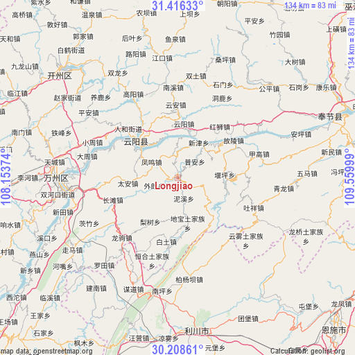
Longjiao GPS coordinates[2]
30° 48' 51.732" North, 108° 51' 24.696" East
| Map corner | latitude | longitude |
|---|---|---|
| Upper-left | 31.41633°, | 108.15374° |
| Center: | 30.81437°, | 108.85686° |
| Lower-right: | 30.20861°, | 109.55999° |
| Map W x H: | 134.3×134.3 km | = 83.5×83.5mi |
| max Lat: | 53.31946° ⇑47% North |
| Longjiao: | 30.81437° |
| min Lat: | ⇓53% South 18.22056° |
| min Long | Longjiao | max Long |
| 75.07348° | 108.85686° | 134.28917° |
| W 23%⇐ | ⇒77% E |
Elevation
Elevation of Longjiao is 182 m = 597 ft, and this is 302.8 m = 993 ft below average elevation for this country.
| Max E: |
5622 m = 18445 ft | 47.9% |
| Avg. | 484.8 m = 1591 ft | |
| Longjiao | 182 m = 597 ft | |
Min E: |
-3 m = -10 ft | 52.1% |
See also: China elevation on elevation.city.
Geographical zone
Longjiao is located in North temperate zone (between Tropic of Cancer and the Arctic Circle). Distance of this Northern Tropic circle is 820.3 km =509.7 mi to South.| Distance of | km | miles | from Longjiao |
|---|---|---|---|
| North Pole | 6580.8 | 4089.1 | to North |
| Arctic Circle | 3974.9 | 2469.9 | to North |
| Tropic Cancer | 820.3 | 509.7 | to South |
| Equator | 3426.2 | 2128.9 | to South |


Nearby cities:
15 places around Longjiao: (largest is in red/bold)
• Baoping
7.7 km =4.8 mi,  355°
355°
• Dibao
17.7 km =11 mi,  168°
168°
• Fengwu
12.1 km =7.5 mi,  301°
301°
• Lishu
19.7 km =12.2 mi,  212°
212°
• Nixi
8.2 km =5.1 mi,  164°
164°
• Panlong
17.4 km =10.8 mi,  306°
306°
• Piaocao
9.5 km =5.9 mi,  105°
105°
• Pu’an
8.9 km =5.5 mi,  47°
47°
• Qinglong
20.2 km =12.6 mi, 310°
• Qingshui
16.1 km =10 mi,  138°
138°
• Tai’an
19 km =11.8 mi,  263°
263°
• Wailang
9.7 km =6 mi,  243°
243°
• Yangshi
18 km =11.2 mi,  90°
90°
• Yaoling
17.8 km =11.1 mi, 167°
• Yunyang
20.5 km =12.7 mi,  6°
6°
Sources, notices
• [Note1] Compared only with cities in China existing in our database
• [Src1] Map data: © OpenStreetMap contributors (CC-BY-SA)
• [Src2] Other city data from geonames.org with taken over terms of usage.
• [Src3] Geographical zone / Annual Mean Temperature by Robert A. Rohde @ Wikipedia
