Linjiang geodata
Linjiang (Chongqing) is a seat of a fourth-order administrative division; located in China in Asia/Shanghai (GMT+8) time zone. In our database, there are 1268 cities with bigger population. Compared to other cities in China, 55.6% of cities are located further ↓South; 79.8% of cities are located further →East and 53.5% of cities have lower elevation than Linjiang. Note1


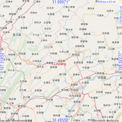
Linjiang GPS coordinates[2]
31° 5' 58.416" North, 108° 13' 10.704" East
| Map corner | latitude | longitude |
|---|---|---|
| Upper-left | 31.69971°, | 107.51652° |
| Center: | 31.09956°, | 108.21964° |
| Lower-right: | 30.49559°, | 108.92277° |
| Map W x H: | 133.9×133.9 km | = 83.2×83.2mi |
| max Lat: | 53.31946° ⇑44.4% North |
| Linjiang: | 31.09956° |
| min Lat: | ⇓55.6% South 18.22056° |
| min Long | Linjiang | max Long |
| 75.07348° | 108.21964° | 134.28917° |
| W 20.2%⇐ | ⇒79.8% E |
Elevation
Elevation of Linjiang is 193 m = 633 ft, and this is 291.8 m = 957 ft below average elevation for this country.
| Max E: |
5622 m = 18445 ft | 46.5% |
| Avg. | 484.8 m = 1591 ft | |
| Linjiang | 193 m = 633 ft | |
Min E: |
-3 m = -10 ft | 53.5% |
See also: China elevation on elevation.city.
Geographical zone
Linjiang is located in North temperate zone (between Tropic of Cancer and the Arctic Circle). Distance of this Northern Tropic circle is 852 km =529.4 mi to South.| Distance of | km | miles | from Linjiang |
|---|---|---|---|
| North Pole | 6549.1 | 4069.4 | to North |
| Arctic Circle | 3943.2 | 2450.2 | to North |
| Tropic Cancer | 852 | 529.4 | to South |
| Equator | 3457.9 | 2148.6 | to South |


Nearby cities:
15 places around Linjiang: (largest is in red/bold)
• Changsha
13.7 km =8.5 mi,  143°
143°
• Dade
17 km =10.6 mi,  42°
42°
• Fengle
21.1 km =13.1 mi,  61°
61°
• Hanfeng
19.1 km =11.9 mi,  66°
66°
• Jiulongshan
11 km =6.8 mi,  15°
15°
• Nanmen
15.5 km =9.6 mi,  171°
171°
• Nanya
12.8 km =8 mi,  262°
262°
• Sanhuikou
20.7 km =12.9 mi,  326°
326°
• Tieqiao
10.5 km =6.5 mi,  231°
231°
• Yihe
14.5 km =9 mi,  296°
296°
• Zhaojia
18.4 km =11.4 mi,  96°
96°
• Zhendong
19.2 km =11.9 mi, 60°
• Zhen’an
10.9 km =6.8 mi, 57°
• Zhonghe
12 km =7.5 mi,  315°
315°
• Zhuxi
7.3 km =4.5 mi, 67°
Sources, notices
• [Note1] Compared only with cities in China existing in our database
• [Src1] Map data: © OpenStreetMap contributors (CC-BY-SA)
• [Src2] Other city data from geonames.org with taken over terms of usage.
• [Src3] Geographical zone / Annual Mean Temperature by Robert A. Rohde @ Wikipedia
