Ligang geodata
Ligang (Jiangsu) is a seat of a fourth-order administrative division; located in China in Asia/Shanghai (GMT+8) time zone. In our database, there are 1268 cities with bigger population. Compared to other cities in China, 60.7% of cities are located further ↓South; 82.4% of cities are located further ←West and 92.7% of cities have higher elevation than Ligang. Note1


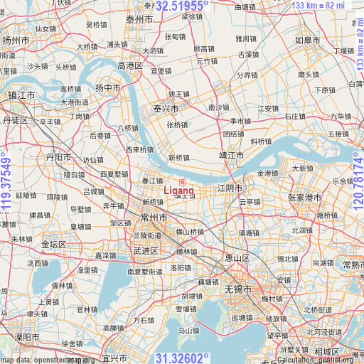
Ligang GPS coordinates[2]
31° 55' 28.992" North, 120° 4' 42.996" East
| Map corner | latitude | longitude |
|---|---|---|
| Upper-left | 32.51955°, | 119.37549° |
| Center: | 31.92472°, | 120.07861° |
| Lower-right: | 31.32602°, | 120.78174° |
| Map W x H: | 132.7×132.7 km | = 82.5×82.5mi |
| max Lat: | 53.31946° ⇑39.3% North |
| Ligang: | 31.92472° |
| min Lat: | ⇓60.7% South 18.22056° |
| min Long | Ligang | max Long |
| 75.07348° | 120.07861° | 134.28917° |
| W 82.4%⇐ | ⇒17.6% E |
Elevation
Elevation of Ligang is 8 m = 26 ft, and this is 476.8 m = 1564 ft below average elevation for this country.
| Max E: |
5622 m = 18445 ft | 92.7% |
| Avg. | 484.8 m = 1591 ft | |
| Ligang | 8 m = 26 ft | |
Min E: |
-3 m = -10 ft | 7.3% |
See also: China elevation on elevation.city.
Geographical zone
Ligang is located in North temperate zone (between Tropic of Cancer and the Arctic Circle). Distance of this Northern Tropic circle is 943.8 km =586.4 mi to South.| Distance of | km | miles | from Ligang |
|---|---|---|---|
| North Pole | 6457.4 | 4012.4 | to North |
| Arctic Circle | 3851.5 | 2393.2 | to North |
| Tropic Cancer | 943.8 | 586.4 | to South |
| Equator | 3549.7 | 2205.7 | to South |


Nearby cities:
15 places around Ligang: (largest is in red/bold)
• Baizhang
10.2 km =6.3 mi,  268°
268°
• Chunjiang
9.1 km =5.7 mi,  285°
285°
• Dongxing
10 km =6.2 mi,  50°
50°
• Hehai
14.3 km =8.9 mi,  221°
221°
• Huangtu
6.9 km =4.3 mi, 215°
• Longhutang
12.1 km =7.5 mi,  229°
229°
• Qixu
12.9 km =8 mi,  332°
332°
• Shengang
7.1 km =4.4 mi,  126°
126°
• Shengci
14.8 km =9.2 mi,  32°
32°
• Shizhuang
5.1 km =3.2 mi,  262°
262°
• Xiagang
12.8 km =8 mi,  104°
104°
• Xinqiao
8.8 km =5.5 mi,  353°
353°
• Xinqiao
13.6 km =8.5 mi,  240°
240°
• Xishiqiao
6.3 km =3.9 mi,  171°
171°
• Zhenglu
10.7 km =6.6 mi,  180°
180°
Sources, notices
• [Note1] Compared only with cities in China existing in our database
• [Src1] Map data: © OpenStreetMap contributors (CC-BY-SA)
• [Src2] Other city data from geonames.org with taken over terms of usage.
• [Src3] Geographical zone / Annual Mean Temperature by Robert A. Rohde @ Wikipedia
