Jinshandian geodata
Jinshandian (Hubei) is a seat of a fourth-order administrative division; located in China in Asia/Shanghai (GMT+8) time zone. In our database, there are 1268 cities with bigger population. Compared to other cities in China, 52.6% of cities are located further ↑North; 53.5% of cities are located further ←West and 73% of cities have higher elevation than Jinshandian. Note1


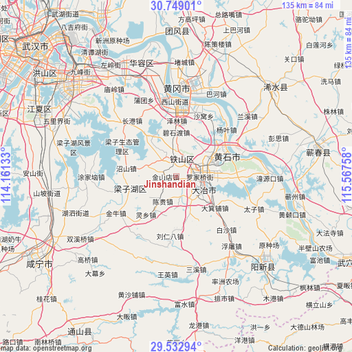
Jinshandian GPS coordinates[2]
30° 8' 34.26" North, 114° 51' 52.02" East
| Map corner | latitude | longitude |
|---|---|---|
| Upper-left | 30.74901°, | 114.16133° |
| Center: | 30.14285°, | 114.86445° |
| Lower-right: | 29.53294°, | 115.56758° |
| Map W x H: | 135.2×135.2 km | = 84×84mi |
| max Lat: | 53.31946° ⇑52.6% North |
| Jinshandian: | 30.14285° |
| min Lat: | ⇓47.4% South 18.22056° |
| min Long | Jinshandian | max Long |
| 75.07348° | 114.86445° | 134.28917° |
| W 53.5%⇐ | ⇒46.5% E |
Elevation
Elevation of Jinshandian is 42 m = 138 ft, and this is 442.8 m = 1453 ft below average elevation for this country.
| Max E: |
5622 m = 18445 ft | 73% |
| Avg. | 484.8 m = 1591 ft | |
| Jinshandian | 42 m = 138 ft | |
Min E: |
-3 m = -10 ft | 27% |
See also: China elevation on elevation.city.
Geographical zone
Jinshandian is located in North temperate zone (between Tropic of Cancer and the Arctic Circle). Distance of this Northern Tropic circle is 745.7 km =463.4 mi to South.| Distance of | km | miles | from Jinshandian |
|---|---|---|---|
| North Pole | 6655.5 | 4135.5 | to North |
| Arctic Circle | 4049.6 | 2516.3 | to North |
| Tropic Cancer | 745.7 | 463.4 | to South |
| Equator | 3351.6 | 2082.6 | to South |


Nearby cities:
15 places around Jinshandian: (largest is in red/bold)
• Bao’an
12.8 km =8 mi,  285°
285°
• Chengui
12 km =7.5 mi,  210°
210°
• Dajipu
18.1 km =11.2 mi,  127°
127°
• Dalukou
19.5 km =12.1 mi,  41°
41°
• Daye
10.6 km =6.6 mi, 128°
• Dengyue
18.5 km =11.5 mi,  74°
74°
• Dongfenglu
11.1 km =6.9 mi,  120°
120°
• Huandiqiao
8.4 km =5.2 mi,  331°
331°
• Huangshi
21.1 km =13.1 mi,  56°
56°
• Laoxialu
11.6 km =7.2 mi, 65°
• Luoqiao
8.6 km =5.3 mi,  87°
87°
• Majiao
10.8 km =6.7 mi,  144°
144°
• Mingshan
13.6 km =8.5 mi,  227°
227°
• Tuanchengshan
17.1 km =10.6 mi, 67°
• Yinzu
20.4 km =12.7 mi,  174°
174°
Sources, notices
• [Note1] Compared only with cities in China existing in our database
• [Src1] Map data: © OpenStreetMap contributors (CC-BY-SA)
• [Src2] Other city data from geonames.org with taken over terms of usage.
• [Src3] Geographical zone / Annual Mean Temperature by Robert A. Rohde @ Wikipedia
