Jingyang geodata
Jingyang (Anhui) is a seat of a third-order administrative division; located in China in Asia/Shanghai (GMT+8) time zone. In our database, there are 1268 cities with bigger population. Compared to other cities in China, 51.3% of cities are located further ↑North; 73.5% of cities are located further ←West and 52.9% of cities have lower elevation than Jingyang. Note1


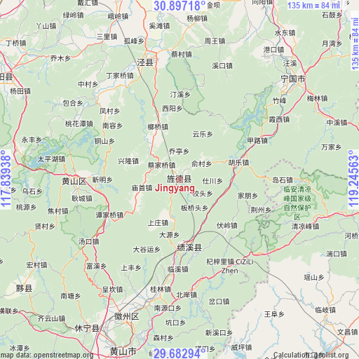
Jingyang GPS coordinates[2]
30° 17' 30.984" North, 118° 32' 33" East
| Map corner | latitude | longitude |
|---|---|---|
| Upper-left | 30.89718°, | 117.83938° |
| Center: | 30.29194°, | 118.5425° |
| Lower-right: | 29.68294°, | 119.24563° |
| Map W x H: | 135×135 km | = 83.9×83.9mi |
| max Lat: | 53.31946° ⇑51.3% North |
| Jingyang: | 30.29194° |
| min Lat: | ⇓48.7% South 18.22056° |
| min Long | Jingyang | max Long |
| 75.07348° | 118.5425° | 134.28917° |
| W 73.5%⇐ | ⇒26.5% E |
Elevation
Elevation of Jingyang is 188 m = 617 ft, and this is 296.8 m = 974 ft below average elevation for this country.
| Max E: |
5622 m = 18445 ft | 47.1% |
| Avg. | 484.8 m = 1591 ft | |
| Jingyang | 188 m = 617 ft | |
Min E: |
-3 m = -10 ft | 52.9% |
See also: China elevation on elevation.city.
Geographical zone
Jingyang is located in North temperate zone (between Tropic of Cancer and the Arctic Circle). Distance of this Northern Tropic circle is 762.2 km =473.6 mi to South.| Distance of | km | miles | from Jingyang |
|---|---|---|---|
| North Pole | 6638.9 | 4125.2 | to North |
| Arctic Circle | 4033 | 2506 | to North |
| Tropic Cancer | 762.2 | 473.6 | to South |
| Equator | 3368.1 | 2092.8 | to South |


Nearby cities:
15 places around Jingyang: (largest is in red/bold)
• Baidi
18.7 km =11.6 mi,  239°
239°
• Banqiaotou
11.6 km =7.2 mi,  151°
151°
• Banshu
7.9 km =4.9 mi,  208°
208°
• Caijiaqiao
9 km =5.6 mi,  309°
309°
• Chang’an
15.7 km =9.8 mi,  188°
188°
• Huatan
4.1 km =2.5 mi,  354°
354°
• Jingqiao
5.1 km =3.2 mi,  60°
60°
• Jinsha
18.2 km =11.3 mi,  99°
99°
• Miaoshou
14.8 km =9.2 mi,  258°
258°
• Qiaoting
10.8 km =6.7 mi,  2°
2°
• Sanxi
14.6 km =9.1 mi, 310°
• Shichuan
12.3 km =7.6 mi,  88°
88°
• Suncun
12.7 km =7.9 mi,  282°
282°
• Yangxi
17.8 km =11.1 mi, 147°
• Yucun
10.6 km =6.6 mi,  53°
53°
Sources, notices
• [Note1] Compared only with cities in China existing in our database
• [Src1] Map data: © OpenStreetMap contributors (CC-BY-SA)
• [Src2] Other city data from geonames.org with taken over terms of usage.
• [Src3] Geographical zone / Annual Mean Temperature by Robert A. Rohde @ Wikipedia
