Suncun geodata
Suncun (Anhui) is a seat of a fourth-order administrative division; located in China in Asia/Shanghai (GMT+8) time zone. In our database, there are 1268 cities with bigger population. Compared to other cities in China, 51% of cities are located further ↑North; 72.7% of cities are located further ←West and 50.1% of cities have lower elevation than Suncun. Note1


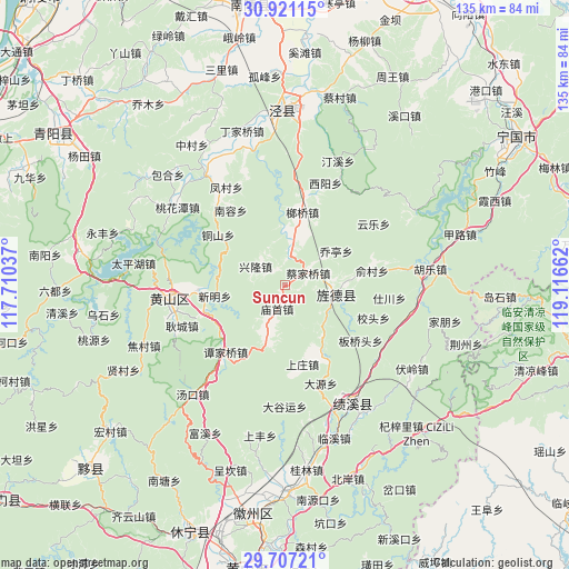
Suncun GPS coordinates[2]
30° 18' 57.816" North, 118° 24' 48.564" East
| Map corner | latitude | longitude |
|---|---|---|
| Upper-left | 30.92115°, | 117.71037° |
| Center: | 30.31606°, | 118.41349° |
| Lower-right: | 29.70721°, | 119.11662° |
| Map W x H: | 135×135 km | = 83.9×83.9mi |
| max Lat: | 53.31946° ⇑51% North |
| Suncun: | 30.31606° |
| min Lat: | ⇓49% South 18.22056° |
| min Long | Suncun | max Long |
| 75.07348° | 118.41349° | 134.28917° |
| W 72.7%⇐ | ⇒27.3% E |
Elevation
Elevation of Suncun is 166 m = 545 ft, and this is 318.8 m = 1046 ft below average elevation for this country.
| Max E: |
5622 m = 18445 ft | 49.9% |
| Avg. | 484.8 m = 1591 ft | |
| Suncun | 166 m = 545 ft | |
Min E: |
-3 m = -10 ft | 50.1% |
See also: China elevation on elevation.city.
Geographical zone
Suncun is located in North temperate zone (between Tropic of Cancer and the Arctic Circle). Distance of this Northern Tropic circle is 764.9 km =475.3 mi to South.| Distance of | km | miles | from Suncun |
|---|---|---|---|
| North Pole | 6636.2 | 4123.5 | to North |
| Arctic Circle | 4030.3 | 2504.3 | to North |
| Tropic Cancer | 764.9 | 475.3 | to South |
| Equator | 3370.8 | 2094.5 | to South |


Nearby cities:
15 places around Suncun: (largest is in red/bold)
• Baidi
12.7 km =7.9 mi,  197°
197°
• Banshu
13 km =8.1 mi,  137°
137°
• Caijiaqiao
6.2 km =3.9 mi,  61°
61°
• Huatan
12 km =7.5 mi,  83°
83°
• Jingqiao
16.8 km =10.4 mi,  90°
90°
• Jingyang
12.7 km =7.9 mi,  102°
102°
• Langqiao
18.4 km =11.4 mi,  11°
11°
• Miaoshou
5.9 km =3.7 mi, 201°
• Qiaoting
15.1 km =9.4 mi, 57°
• Sankou
20.2 km =12.6 mi,  251°
251°
• Sanxi
7 km =4.3 mi, 11°
• Tongshan
19.9 km =12.4 mi,  307°
307°
• Xianyuan
20.5 km =12.7 mi,  266°
266°
• Xinglong
8.3 km =5.2 mi,  303°
303°
• Xinming
16.4 km =10.2 mi,  277°
277°
Sources, notices
• [Note1] Compared only with cities in China existing in our database
• [Src1] Map data: © OpenStreetMap contributors (CC-BY-SA)
• [Src2] Other city data from geonames.org with taken over terms of usage.
• [Src3] Geographical zone / Annual Mean Temperature by Robert A. Rohde @ Wikipedia
