Jiangkou geodata
Jiangkou (Shaanxi) is a seat of a fourth-order administrative division; located in China in Asia/Shanghai (GMT+8) time zone. In our database, there are 1268 cities with bigger population. Compared to other cities in China, 68.8% of cities are located further ↓South; 83.5% of cities are located further →East and 86.9% of cities have lower elevation than Jiangkou. Note1


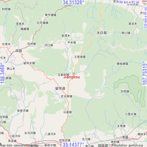
Jiangkou GPS coordinates[2]
33° 43' 49.872" North, 107° 3' 0.072" East
| Map corner | latitude | longitude |
|---|---|---|
| Upper-left | 34.31328°, | 106.3469° |
| Center: | 33.73052°, | 107.05002° |
| Lower-right: | 33.14377°, | 107.75315° |
| Map W x H: | 130×130 km | = 80.8×80.8mi |
| max Lat: | 53.31946° ⇑31.2% North |
| Jiangkou: | 33.73052° |
| min Lat: | ⇓68.8% South 18.22056° |
| min Long | Jiangkou | max Long |
| 75.07348° | 107.05002° | 134.28917° |
| W 16.5%⇐ | ⇒83.5% E |
Elevation
Elevation of Jiangkou is 1106 m = 3629 ft, and this is 621.2 m = 2038 ft above average elevation for this country.
| Max E: |
5622 m = 18445 ft | 13.1% |
| Jiangkou | 1106 m 3629 ft | |
| Avg. | 484.8 m = 1591 ft | |
Min E: |
-3 m = -10 ft | 86.9% |
See also: China elevation on elevation.city.
Geographical zone
Jiangkou is located in North temperate zone (between Tropic of Cancer and the Arctic Circle). Distance of this Northern Tropic circle is 1144.6 km =711.2 mi to South.| Distance of | km | miles | from Jiangkou |
|---|---|---|---|
| North Pole | 6256.6 | 3887.7 | to North |
| Arctic Circle | 3650.7 | 2268.4 | to North |
| Tropic Cancer | 1144.6 | 711.2 | to South |
| Equator | 3750.5 | 2330.5 | to South |


Nearby cities:
15 places around Jiangkou: (largest is in red/bold)
• Fengzhou
45.8 km =28.5 mi,  306°
306°
• Hekou
33.4 km =20.8 mi,  319°
319°
• Huoshaodian
24.1 km =15 mi,  209°
209°
• Liuba
17.4 km =10.8 mi,  224°
224°
• Liuhou
19 km =11.8 mi,  257°
257°
• Madao
34.4 km =21.4 mi,  187°
187°
• Nanxing
35.3 km =21.9 mi,  276°
276°
• Pingkan
15.6 km =9.7 mi,  341°
341°
• Pingmu
27.9 km =17.3 mi,  356°
356°
• Qingqiaoyi
45.2 km =28.1 mi, 188°
• Sancha
37 km =23 mi,  289°
289°
• Wuguanyi
21 km =13 mi,  198°
198°
• Yanwan
34.4 km =21.4 mi,  348°
348°
• Yuhuangmiao
9.4 km =5.8 mi,  267°
267°
• Zuitou
44.1 km =27.4 mi,  33°
33°
Sources, notices
• [Note1] Compared only with cities in China existing in our database
• [Src1] Map data: © OpenStreetMap contributors (CC-BY-SA)
• [Src2] Other city data from geonames.org with taken over terms of usage.
• [Src3] Geographical zone / Annual Mean Temperature by Robert A. Rohde @ Wikipedia
