Pingmu geodata
Pingmu (Shaanxi) is a seat of a fourth-order administrative division; located in China in Asia/Shanghai (GMT+8) time zone. In our database, there are 1268 cities with bigger population. Compared to other cities in China, 70% of cities are located further ↓South; 83.6% of cities are located further →East and 88.9% of cities have lower elevation than Pingmu. Note1


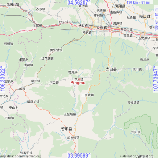
Pingmu GPS coordinates[2]
33° 58' 51.708" North, 107° 2' 0.024" East
| Map corner | latitude | longitude |
|---|---|---|
| Upper-left | 34.56207°, | 106.33022° |
| Center: | 33.98103°, | 107.03334° |
| Lower-right: | 33.39599°, | 107.73647° |
| Map W x H: | 129.7×129.7 km | = 80.6×80.6mi |
| max Lat: | 53.31946° ⇑30% North |
| Pingmu: | 33.98103° |
| min Lat: | ⇓70% South 18.22056° |
| min Long | Pingmu | max Long |
| 75.07348° | 107.03334° | 134.28917° |
| W 16.4%⇐ | ⇒83.6% E |
Elevation
Elevation of Pingmu is 1258 m = 4127 ft, and this is 773.2 m = 2537 ft above average elevation for this country.
| Max E: |
5622 m = 18445 ft | 11.1% |
| Pingmu | 1258 m 4127 ft | |
| Avg. | 484.8 m = 1591 ft | |
Min E: |
-3 m = -10 ft | 88.9% |
See also: China elevation on elevation.city.
Geographical zone
Pingmu is located in North temperate zone (between Tropic of Cancer and the Arctic Circle). Distance of this Northern Tropic circle is 1172.4 km =728.5 mi to South.| Distance of | km | miles | from Pingmu |
|---|---|---|---|
| North Pole | 6228.7 | 3870.3 | to North |
| Arctic Circle | 3622.8 | 2251.1 | to North |
| Tropic Cancer | 1172.4 | 728.5 | to South |
| Equator | 3778.3 | 2347.7 | to South |


Nearby cities:
15 places around Pingmu: (largest is in red/bold)
• Fengzhou
35.2 km =21.9 mi,  269°
269°
• Gaojia
42.3 km =26.3 mi,  4°
4°
• Hekou
20.3 km =12.6 mi,  263°
263°
• Jiangkou
27.9 km =17.3 mi,  176°
176°
• Liuba
41.7 km =25.9 mi,  194°
194°
• Liuhou
36.3 km =22.6 mi,  207°
207°
• Nanxing
41 km =25.5 mi,  234°
234°
• Pingkan
13.4 km =8.3 mi, 194°
• Sancha
36.8 km =22.9 mi,  244°
244°
• Shennong
40.6 km =25.2 mi,  10°
10°
• Shigu
42.4 km =26.3 mi, 13°
• Tangzang
43.2 km =26.8 mi,  286°
286°
• Yanwan
7.7 km =4.8 mi,  319°
319°
• Yuhuangmiao
29.3 km =18.2 mi,  195°
195°
• Zuitou
27.3 km =17 mi,  70°
70°
Sources, notices
• [Note1] Compared only with cities in China existing in our database
• [Src1] Map data: © OpenStreetMap contributors (CC-BY-SA)
• [Src2] Other city data from geonames.org with taken over terms of usage.
• [Src3] Geographical zone / Annual Mean Temperature by Robert A. Rohde @ Wikipedia
