Huacheng geodata
Huacheng (Yunnan) is a seat of a fourth-order administrative division; located in China in Asia/Shanghai (GMT+8) time zone. In our database, there are 1268 cities with bigger population. Compared to other cities in China, 87.3% of cities are located further ↑North; 91.8% of cities are located further →East and 94.4% of cities have lower elevation than Huacheng. Note1


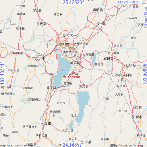
Huacheng GPS coordinates[2]
24° 47' 18.744" North, 102° 48' 22.428" East
| Map corner | latitude | longitude |
|---|---|---|
| Upper-left | 25.42523°, | 102.10311° |
| Center: | 24.78854°, | 102.80623° |
| Lower-right: | 24.14857°, | 103.50936° |
| Map W x H: | 142×142 km | = 88.2×88.2mi |
| max Lat: | 53.31946° ⇑87.3% North |
| Huacheng: | 24.78854° |
| min Lat: | ⇓12.7% South 18.22056° |
| min Long | Huacheng | max Long |
| 75.07348° | 102.80623° | 134.28917° |
| W 8.2%⇐ | ⇒91.8% E |
Elevation
Elevation of Huacheng is 1935 m = 6348 ft, and this is 1450.2 m = 4758 ft above average elevation for this country.
| Max E: |
5622 m = 18445 ft | 5.6% |
| Huacheng | 1935 m 6348 ft | |
| Avg. | 484.8 m = 1591 ft | |
Min E: |
-3 m = -10 ft | 94.4% |
See also: China elevation on elevation.city.
Geographical zone
Huacheng is located in North temperate zone (between Tropic of Cancer and the Arctic Circle). Distance of this Northern Tropic circle is 150.3 km =93.4 mi to South.| Distance of | km | miles | from Huacheng |
|---|---|---|---|
| North Pole | 7250.8 | 4505.4 | to North |
| Arctic Circle | 4644.9 | 2886.2 | to North |
| Tropic Cancer | 150.3 | 93.4 | to South |
| Equator | 2756.2 | 1712.6 | to South |


Nearby cities:
15 places around Huacheng: (largest is in red/bold)
• Fenglu
16.4 km =10.2 mi,  139°
139°
• Geyang
15.9 km =9.9 mi,  358°
358°
• Huayue
19.4 km =12.1 mi,  196°
196°
• Jincheng
11.5 km =7.1 mi,  213°
213°
• Jiulong
20.5 km =12.7 mi,  121°
121°
• Laojiangjunjie
15.4 km =9.6 mi,  218°
218°
• Longcheng
12.2 km =7.6 mi, 356°
• Longjie
17.7 km =11 mi,  150°
150°
• Luoyang
15.7 km =9.8 mi, 359°
• Taipingguan
4.9 km =3 mi,  341°
341°
• Wujiaying
10.4 km =6.5 mi,  22°
22°
• Xiaojie
20.5 km =12.7 mi, 141°
• Xiaowangjiaying
13.9 km =8.6 mi,  353°
353°
• Xinjie
9.9 km =6.2 mi,  240°
240°
• Yangzongnan Hengjie
16.9 km =10.5 mi,  77°
77°
Sources, notices
• [Note1] Compared only with cities in China existing in our database
• [Src1] Map data: © OpenStreetMap contributors (CC-BY-SA)
• [Src2] Other city data from geonames.org with taken over terms of usage.
• [Src3] Geographical zone / Annual Mean Temperature by Robert A. Rohde @ Wikipedia
