Jincheng geodata
Jincheng (Yunnan) is a seat of a fourth-order administrative division; located in China in Asia/Shanghai (GMT+8) time zone. In our database, there are 1268 cities with bigger population. Compared to other cities in China, 87.6% of cities are located further ↑North; 92% of cities are located further →East and 94.4% of cities have lower elevation than Jincheng. Note1


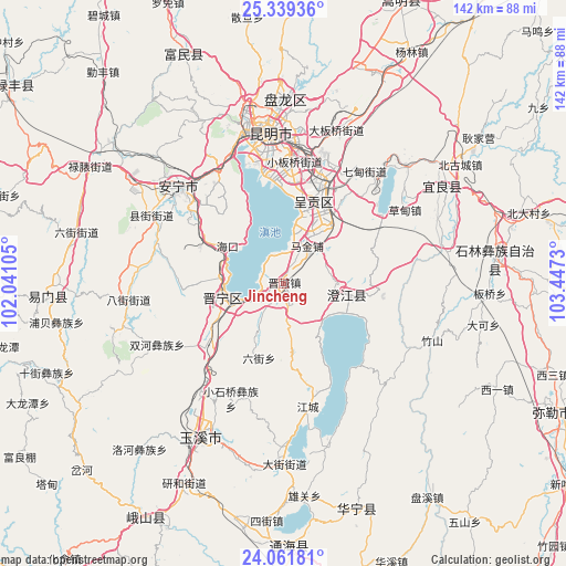
Jincheng GPS coordinates[2]
24° 42' 7.992" North, 102° 44' 39.012" East
| Map corner | latitude | longitude |
|---|---|---|
| Upper-left | 25.33936°, | 102.04105° |
| Center: | 24.70222°, | 102.74417° |
| Lower-right: | 24.06181°, | 103.4473° |
| Map W x H: | 142.1×142.1 km | = 88.3×88.3mi |
| max Lat: | 53.31946° ⇑87.6% North |
| Jincheng: | 24.70222° |
| min Lat: | ⇓12.4% South 18.22056° |
| min Long | Jincheng | max Long |
| 75.07348° | 102.74417° | 134.28917° |
| W 8%⇐ | ⇒92% E |
Elevation
Elevation of Jincheng is 1911 m = 6270 ft, and this is 1426.2 m = 4679 ft above average elevation for this country.
| Max E: |
5622 m = 18445 ft | 5.6% |
| Jincheng | 1911 m 6270 ft | |
| Avg. | 484.8 m = 1591 ft | |
Min E: |
-3 m = -10 ft | 94.4% |
See also: China elevation on elevation.city.
Geographical zone
Jincheng is located in North temperate zone (between Tropic of Cancer and the Arctic Circle). Distance of this Northern Tropic circle is 140.7 km =87.4 mi to South.| Distance of | km | miles | from Jincheng |
|---|---|---|---|
| North Pole | 7260.4 | 4511.4 | to North |
| Arctic Circle | 4654.5 | 2892.2 | to North |
| Tropic Cancer | 140.7 | 87.4 | to South |
| Equator | 2746.6 | 1706.7 | to South |


Nearby cities:
15 places around Jincheng: (largest is in red/bold)
• Fenglu
17.1 km =10.6 mi,  99°
99°
• Haikou
19.1 km =11.9 mi,  296°
296°
• Huacheng
11.5 km =7.1 mi,  33°
33°
• Huayue
9.1 km =5.7 mi,  174°
174°
• Huichang
15.7 km =9.8 mi,  285°
285°
• Jiulong
23.8 km =14.8 mi,  92°
92°
• Kunyang
15.9 km =9.9 mi,  255°
255°
• Laojiangjunjie
4.1 km =2.5 mi,  232°
232°
• Liujie
19.3 km =12 mi,  197°
197°
• Longcheng
22.5 km =14 mi,  14°
14°
• Longjie
16 km =9.9 mi,  111°
111°
• Taipingguan
15 km =9.3 mi,  18°
18°
• Wujiaying
21.8 km =13.5 mi, 27°
• Xiaojie
20 km =12.4 mi, 108°
• Xinjie
5.2 km =3.2 mi,  333°
333°
Sources, notices
• [Note1] Compared only with cities in China existing in our database
• [Src1] Map data: © OpenStreetMap contributors (CC-BY-SA)
• [Src2] Other city data from geonames.org with taken over terms of usage.
• [Src3] Geographical zone / Annual Mean Temperature by Robert A. Rohde @ Wikipedia
