Guozhuang geodata
Guozhuang (Hebei) is a seat of a fourth-order administrative division; located in China in Asia/Shanghai (GMT+8) time zone. In our database, there are 1268 cities with bigger population. Compared to other cities in China, 81.3% of cities are located further ↓South; 53.5% of cities are located further ←West and 68.7% of cities have higher elevation than Guozhuang. Note1


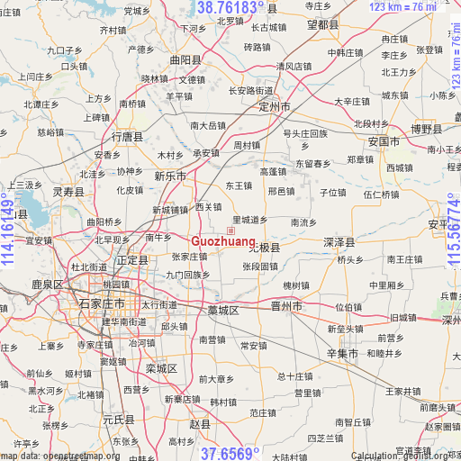
Guozhuang GPS coordinates[2]
38° 12' 41.256" North, 114° 51' 52.596" East
| Map corner | latitude | longitude |
|---|---|---|
| Upper-left | 38.76183°, | 114.16149° |
| Center: | 38.21146°, | 114.86461° |
| Lower-right: | 37.6569°, | 115.56774° |
| Map W x H: | 122.9×122.9 km | = 76.4×76.4mi |
| max Lat: | 53.31946° ⇑18.7% North |
| Guozhuang: | 38.21146° |
| min Lat: | ⇓81.3% South 18.22056° |
| min Long | Guozhuang | max Long |
| 75.07348° | 114.86461° | 134.28917° |
| W 53.5%⇐ | ⇒46.5% E |
Elevation
Elevation of Guozhuang is 57 m = 187 ft, and this is 427.8 m = 1404 ft below average elevation for this country.
| Max E: |
5622 m = 18445 ft | 68.7% |
| Avg. | 484.8 m = 1591 ft | |
| Guozhuang | 57 m = 187 ft | |
Min E: |
-3 m = -10 ft | 31.3% |
See also: China elevation on elevation.city.
Geographical zone
Guozhuang is located in North temperate zone (between Tropic of Cancer and the Arctic Circle). Distance of this Northern Tropic circle is 1642.8 km =1020.8 mi to South.| Distance of | km | miles | from Guozhuang |
|---|---|---|---|
| North Pole | 5758.3 | 3578 | to North |
| Arctic Circle | 3152.5 | 1958.9 | to North |
| Tropic Cancer | 1642.8 | 1020.8 | to South |
| Equator | 4248.7 | 2640 | to South |


Nearby cities:
15 places around Guozhuang: (largest is in red/bold)
• Beisu
8.1 km =5 mi,  218°
218°
• Donghoufang
4.3 km =2.7 mi,  138°
138°
• Gaopeng
19.4 km =12.1 mi,  35°
35°
• Hantai
12 km =7.5 mi,  347°
347°
• Haozhuang
14.9 km =9.3 mi,  187°
187°
• Jiumen
16.5 km =10.3 mi,  225°
225°
• Lichengdao
5.9 km =3.7 mi,  62°
62°
• Nandong
15.2 km =9.4 mi, 217°
• Nanmeng
7.8 km =4.8 mi,  265°
265°
• Xiguan
9.1 km =5.7 mi,  319°
319°
• Xinchengpu
17 km =10.6 mi,  291°
291°
• Xizhong
12.8 km =8 mi,  30°
30°
• Zengcun
11.8 km =7.3 mi, 288°
• Zhangduangu
11.1 km =6.9 mi, 142°
• Zhangjiazhuang
11.9 km =7.4 mi,  249°
249°
Sources, notices
• [Note1] Compared only with cities in China existing in our database
• [Src1] Map data: © OpenStreetMap contributors (CC-BY-SA)
• [Src2] Other city data from geonames.org with taken over terms of usage.
• [Src3] Geographical zone / Annual Mean Temperature by Robert A. Rohde @ Wikipedia
