Gudian geodata
Gudian (Anhui) is a seat of a fourth-order administrative division; located in China in Asia/Shanghai (GMT+8) time zone. In our database, there are 1268 cities with bigger population. Compared to other cities in China, 65.4% of cities are located further ↓South; 63.3% of cities are located further ←West and 80.2% of cities have higher elevation than Gudian. Note1


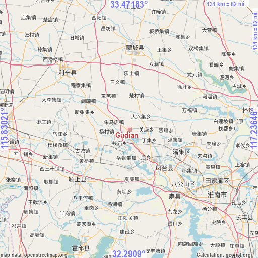
Gudian GPS coordinates[2]
32° 52' 59.988" North, 116° 31' 59.988" East
| Map corner | latitude | longitude |
|---|---|---|
| Upper-left | 33.47183°, | 115.83021° |
| Center: | 32.88333°, | 116.53333° |
| Lower-right: | 32.2909°, | 117.23646° |
| Map W x H: | 131.3×131.3 km | = 81.6×81.6mi |
| max Lat: | 53.31946° ⇑34.6% North |
| Gudian: | 32.88333° |
| min Lat: | ⇓65.4% South 18.22056° |
| min Long | Gudian | max Long |
| 75.07348° | 116.53333° | 134.28917° |
| W 63.3%⇐ | ⇒36.7% E |
Elevation
Elevation of Gudian is 26 m = 85 ft, and this is 458.8 m = 1505 ft below average elevation for this country.
| Max E: |
5622 m = 18445 ft | 80.2% |
| Avg. | 484.8 m = 1591 ft | |
| Gudian | 26 m = 85 ft | |
Min E: |
-3 m = -10 ft | 19.8% |
See also: China elevation on elevation.city.
Geographical zone
Gudian is located in North temperate zone (between Tropic of Cancer and the Arctic Circle). Distance of this Northern Tropic circle is 1050.4 km =652.7 mi to South.| Distance of | km | miles | from Gudian |
|---|---|---|---|
| North Pole | 6350.8 | 3946.2 | to North |
| Arctic Circle | 3744.9 | 2327 | to North |
| Tropic Cancer | 1050.4 | 652.7 | to South |
| Equator | 3656.3 | 2271.9 | to South |


Nearby cities:
15 places around Gudian: (largest is in red/bold)
• Bengbu
77.5 km =48.2 mi,  85°
85°
• Datong
57.5 km =35.7 mi,  120°
120°
• Fengtai Chengguanzhen
26.7 km =16.6 mi,  136°
136°
• Fuyang
66.9 km =41.6 mi,  271°
271°
• Guoyang Chengguanzhen
74.7 km =46.4 mi,  337°
337°
• Huainan
51.9 km =32.2 mi, 123°
• Huaiyuan Chengguanzhen
59.6 km =37 mi,  81°
81°
• Huoqiu Chengguanzhen
62.9 km =39.1 mi,  200°
200°
• Jiulonggang
58.9 km =36.6 mi, 119°
• Liufu
76.1 km =47.3 mi,  98°
98°
• Lixin Chengguanzhen
40.6 km =25.2 mi,  315°
315°
• Mengcheng Chengguanzhen
42.7 km =26.5 mi,  4°
4°
• Shouchun
41.4 km =25.7 mi, 144°
• Yaokou
53.4 km =33.2 mi,  154°
154°
• Yingshang Chengguanzhen
37.5 km =23.3 mi,  221°
221°
Sources, notices
• [Note1] Compared only with cities in China existing in our database
• [Src1] Map data: © OpenStreetMap contributors (CC-BY-SA)
• [Src2] Other city data from geonames.org with taken over terms of usage.
• [Src3] Geographical zone / Annual Mean Temperature by Robert A. Rohde @ Wikipedia
