Bengbu geodata
Bengbu (Anhui) is a populated place; located in China in Asia/Shanghai (GMT+8) time zone. With population of 576,648 people, there are 113 cities with bigger population in this country. Compared to other cities in China, 65.8% of cities are located further ↓South; 68.1% of cities are located further ←West and 77.7% of cities have higher elevation than Bengbu. Note1


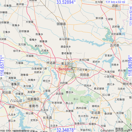
Bengbu GPS coordinates[2]
32° 56' 26.988" North, 117° 21' 38.988" East
| Map corner | latitude | longitude |
|---|---|---|
| Upper-left | 33.52894°, | 116.65771° |
| Center: | 32.94083°, | 117.36083° |
| Lower-right: | 32.34878°, | 118.06396° |
| Map W x H: | 131.2×131.2 km | = 81.5×81.5mi |
| max Lat: | 53.31946° ⇑34.2% North |
| Bengbu: | 32.94083° |
| min Lat: | ⇓65.8% South 18.22056° |
| min Long | Bengbu | max Long |
| 75.07348° | 117.36083° | 134.28917° |
| W 68.1%⇐ | ⇒31.9% E |
Elevation
Elevation of Bengbu is 31 m = 102 ft, and this is 453.8 m = 1489 ft below average elevation for this country.
| Max E: |
5622 m = 18445 ft | 77.7% |
| Avg. | 484.8 m = 1591 ft | |
| Bengbu | 31 m = 102 ft | |
Min E: |
-3 m = -10 ft | 22.3% |
See also: Bengbu elevation on elevation.city.
Geographical zone
Bengbu is located in North temperate zone (between Tropic of Cancer and the Arctic Circle). Distance of this Northern Tropic circle is 1056.8 km =656.7 mi to South.| Distance of | km | miles | from Bengbu |
|---|---|---|---|
| North Pole | 6344.4 | 3942.2 | to North |
| Arctic Circle | 3738.5 | 2323 | to North |
| Tropic Cancer | 1056.8 | 656.7 | to South |
| Equator | 3662.7 | 2275.9 | to South |


Nearby cities:
15 places around Bengbu: (largest is in red/bold)
• Datong
45.2 km =28.1 mi,  218°
218°
• Dingcheng
54.9 km =34.1 mi,  149°
149°
• Fengtai Chengguanzhen
64.4 km =40 mi,  246°
246°
• Fengyang Fuchengzhen
18.5 km =11.5 mi,  111°
111°
• Guzhen Chengguanzhen
41.4 km =25.7 mi,  353°
353°
• Huainan
48.8 km =30.3 mi, 224°
• Huaiyuan Chengguanzhen
18.3 km =11.4 mi,  276°
276°
• Jiulonggang
44.3 km =27.5 mi, 216°
• Lingcheng
68.3 km =42.4 mi,  13°
13°
• Liufu
18.4 km =11.4 mi,  186°
186°
• Mingguang
59.1 km =36.7 mi, 107°
• Shouchun
66.4 km =41.3 mi,  233°
233°
• Sicheng
76.5 km =47.5 mi,  37°
37°
• Wuhe Chengguanzhen
52 km =32.3 mi,  64°
64°
• Yaokou
77 km =47.8 mi, 224°
Sources, notices
• [Note1] Compared only with cities in China existing in our database
• [Src1] Map data: © OpenStreetMap contributors (CC-BY-SA)
• [Src2] Other city data from geonames.org with taken over terms of usage.
• [Src3] Geographical zone / Annual Mean Temperature by Robert A. Rohde @ Wikipedia
