Gelan geodata
Gelan (Chongqing) is a seat of a fourth-order administrative division; located in China in Asia/Shanghai (GMT+8) time zone. In our database, there are 1268 cities with bigger population. Compared to other cities in China, 53.6% of cities are located further ↑North; 83.3% of cities are located further →East and 65.5% of cities have lower elevation than Gelan. Note1


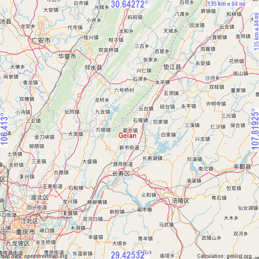
Gelan GPS coordinates[2]
30° 2' 9.204" North, 107° 6' 58.032" East
| Map corner | latitude | longitude |
|---|---|---|
| Upper-left | 30.64272°, | 106.413° |
| Center: | 30.03589°, | 107.11612° |
| Lower-right: | 29.42532°, | 107.81925° |
| Map W x H: | 135.4×135.4 km | = 84.1×84.1mi |
| max Lat: | 53.31946° ⇑53.6% North |
| Gelan: | 30.03589° |
| min Lat: | ⇓46.4% South 18.22056° |
| min Long | Gelan | max Long |
| 75.07348° | 107.11612° | 134.28917° |
| W 16.7%⇐ | ⇒83.3% E |
Elevation
Elevation of Gelan is 334 m = 1096 ft, and this is 150.8 m = 495 ft below average elevation for this country.
| Max E: |
5622 m = 18445 ft | 34.5% |
| Avg. | 484.8 m = 1591 ft | |
| Gelan | 334 m = 1096 ft | |
Min E: |
-3 m = -10 ft | 65.5% |
See also: China elevation on elevation.city.
Geographical zone
Gelan is located in North temperate zone (between Tropic of Cancer and the Arctic Circle). Distance of this Northern Tropic circle is 733.8 km =456 mi to South.| Distance of | km | miles | from Gelan |
|---|---|---|---|
| North Pole | 6667.4 | 4142.9 | to North |
| Arctic Circle | 4061.5 | 2523.7 | to North |
| Tropic Cancer | 733.8 | 456 | to South |
| Equator | 3339.7 | 2075.2 | to South |


Nearby cities:
15 places around Gelan: (largest is in red/bold)
• Baijia
20.3 km =12.6 mi,  95°
95°
• Bake
17.5 km =10.9 mi,  210°
210°
• Baojia
16.8 km =10.4 mi,  74°
74°
• Changshouhu
18.7 km =11.6 mi,  141°
141°
• Dandu
22.3 km =13.9 mi,  172°
172°
• Duzhou
17.9 km =11.1 mi,  191°
191°
• Haitang
18.7 km =11.6 mi,  35°
35°
• Honghu
16.3 km =10.1 mi,  255°
255°
• Linfeng
19 km =11.8 mi,  148°
148°
• Longhe
6.5 km =4 mi,  108°
108°
• Shiyan
7.6 km =4.7 mi,  45°
45°
• Shuanglong
11.9 km =7.4 mi, 135°
• Wanshun
13.9 km =8.6 mi,  271°
271°
• Xinshi
8.5 km =5.3 mi, 187°
• Yuntai
14.3 km =8.9 mi, 36°
Sources, notices
• [Note1] Compared only with cities in China existing in our database
• [Src1] Map data: © OpenStreetMap contributors (CC-BY-SA)
• [Src2] Other city data from geonames.org with taken over terms of usage.
• [Src3] Geographical zone / Annual Mean Temperature by Robert A. Rohde @ Wikipedia
