Gaotuan geodata
Gaotuan (Shandong) is a seat of a fourth-order administrative division; located in China in Asia/Shanghai (GMT+8) time zone. In our database, there are 1268 cities with bigger population. Compared to other cities in China, 80.2% of cities are located further ↓South; 88.4% of cities are located further ←West and 72.3% of cities have higher elevation than Gaotuan. Note1


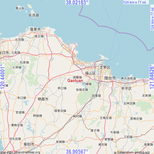
Gaotuan GPS coordinates[2]
37° 27' 56.988" North, 121° 8' 35.268" East
| Map corner | latitude | longitude |
|---|---|---|
| Upper-left | 38.02183°, | 120.44001° |
| Center: | 37.46583°, | 121.14313° |
| Lower-right: | 36.90567°, | 121.84626° |
| Map W x H: | 124.1×124.1 km | = 77.1×77.1mi |
| max Lat: | 53.31946° ⇑19.8% North |
| Gaotuan: | 37.46583° |
| min Lat: | ⇓80.2% South 18.22056° |
| min Long | Gaotuan | max Long |
| 75.07348° | 121.14313° | 134.28917° |
| W 88.4%⇐ | ⇒11.6% E |
Elevation
Elevation of Gaotuan is 44 m = 144 ft, and this is 440.8 m = 1446 ft below average elevation for this country.
| Max E: |
5622 m = 18445 ft | 72.3% |
| Avg. | 484.8 m = 1591 ft | |
| Gaotuan | 44 m = 144 ft | |
Min E: |
-3 m = -10 ft | 27.7% |
See also: China elevation on elevation.city.
Geographical zone
Gaotuan is located in North temperate zone (between Tropic of Cancer and the Arctic Circle). Distance of this Northern Tropic circle is 1559.9 km =969.3 mi to South.| Distance of | km | miles | from Gaotuan |
|---|---|---|---|
| North Pole | 5841.3 | 3629.6 | to North |
| Arctic Circle | 3235.4 | 2010.4 | to North |
| Tropic Cancer | 1559.9 | 969.3 | to South |
| Equator | 4165.8 | 2588.5 | to South |


Nearby cities:
15 places around Gaotuan: (largest is in red/bold)
• Dajijia
23.7 km =14.7 mi,  340°
340°
• Daliuhang
18 km =11.2 mi,  332°
332°
• Fenghuangtai
18.1 km =11.2 mi,  63°
63°
• Fuxin
8.5 km =5.3 mi,  34°
34°
• Guxian
12 km =7.5 mi,  351°
351°
• Huili
21.4 km =13.3 mi,  133°
133°
• Laishan
22.5 km =14 mi,  111°
111°
• Menlou
9.5 km =5.9 mi,  124°
124°
• Qingyang
10.7 km =6.6 mi,  71°
71°
• Shihuiyao
20.4 km =12.7 mi,  76°
76°
• Xiangyang
23.3 km =14.5 mi, 71°
• Xinfu
21 km =13 mi, 57°
• Zangjiazhuang
13.9 km =8.6 mi,  270°
270°
• Zhanggezhuang
10.8 km =6.7 mi,  159°
159°
• Zhichu
15.7 km =9.8 mi, 68°
Sources, notices
• [Note1] Compared only with cities in China existing in our database
• [Src1] Map data: © OpenStreetMap contributors (CC-BY-SA)
• [Src2] Other city data from geonames.org with taken over terms of usage.
• [Src3] Geographical zone / Annual Mean Temperature by Robert A. Rohde @ Wikipedia
