Zhanggezhuang geodata
Zhanggezhuang (Shandong) is a seat of a fourth-order administrative division; located in China in Asia/Shanghai (GMT+8) time zone. In our database, there are 1268 cities with bigger population. Compared to other cities in China, 80% of cities are located further ↓South; 88.6% of cities are located further ←West and 73% of cities have higher elevation than Zhanggezhuang. Note1


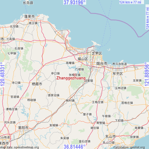
Zhanggezhuang GPS coordinates[2]
37° 22' 31.044" North, 121° 11' 11.148" East
| Map corner | latitude | longitude |
|---|---|---|
| Upper-left | 37.93196°, | 120.48331° |
| Center: | 37.37529°, | 121.18643° |
| Lower-right: | 36.81446°, | 121.88956° |
| Map W x H: | 124.3×124.3 km | = 77.2×77.2mi |
| max Lat: | 53.31946° ⇑20% North |
| Zhanggezhuang: | 37.37529° |
| min Lat: | ⇓80% South 18.22056° |
| min Long | Zhanggezhuang | max Long |
| 75.07348° | 121.18643° | 134.28917° |
| W 88.6%⇐ | ⇒11.4% E |
Elevation
Elevation of Zhanggezhuang is 42 m = 138 ft, and this is 442.8 m = 1453 ft below average elevation for this country.
| Max E: |
5622 m = 18445 ft | 73% |
| Avg. | 484.8 m = 1591 ft | |
| Zhanggezhuang | 42 m = 138 ft | |
Min E: |
-3 m = -10 ft | 27% |
See also: China elevation on elevation.city.
Geographical zone
Zhanggezhuang is located in North temperate zone (between Tropic of Cancer and the Arctic Circle). Distance of this Northern Tropic circle is 1549.8 km =963 mi to South.| Distance of | km | miles | from Zhanggezhuang |
|---|---|---|---|
| North Pole | 5851.3 | 3635.8 | to North |
| Arctic Circle | 3245.4 | 2016.6 | to North |
| Tropic Cancer | 1549.8 | 963 | to South |
| Equator | 4155.7 | 2582.2 | to South |


Nearby cities:
15 places around Zhanggezhuang: (largest is in red/bold)
• Binhailu
22.8 km =14.2 mi,  71°
71°
• Fenghuangtai
22.1 km =13.7 mi,  34°
34°
• Fuxin
17.1 km =10.6 mi,  3°
3°
• Gaotuan
10.8 km =6.7 mi,  339°
339°
• Guanshui
18.9 km =11.7 mi,  158°
158°
• Guxian
22.6 km =14 mi,  345°
345°
• Huili
12.6 km =7.8 mi,  111°
111°
• Laishan
17.2 km =10.7 mi,  83°
83°
• Menlou
6.2 km =3.9 mi,  40°
40°
• Qingyang
14.8 km =9.2 mi, 25°
• Shihuiyao
21.9 km =13.6 mi,  47°
47°
• Tangjiapo
24.4 km =15.2 mi,  226°
226°
• Yantai
25.1 km =15.6 mi,  63°
63°
• Zangjiazhuang
20.4 km =12.7 mi,  299°
299°
• Zhichu
19.2 km =11.9 mi, 34°
Sources, notices
• [Note1] Compared only with cities in China existing in our database
• [Src1] Map data: © OpenStreetMap contributors (CC-BY-SA)
• [Src2] Other city data from geonames.org with taken over terms of usage.
• [Src3] Geographical zone / Annual Mean Temperature by Robert A. Rohde @ Wikipedia
