Fuxing geodata
Fuxing (Guizhou) is a seat of a fourth-order administrative division; located in China in Asia/Shanghai (GMT+8) time zone. In our database, there are 1268 cities with bigger population. Compared to other cities in China, 73.4% of cities are located further ↑North; 80.9% of cities are located further →East and 81.2% of cities have lower elevation than Fuxing. Note1


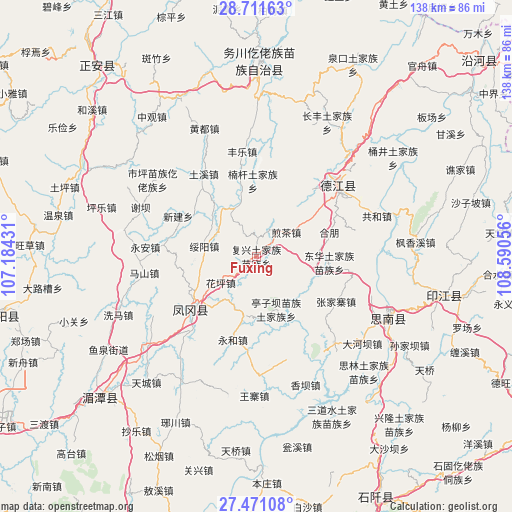
Fuxing GPS coordinates[2]
28° 5' 35.34" North, 107° 53' 14.748" East
| Map corner | latitude | longitude |
|---|---|---|
| Upper-left | 28.71163°, | 107.18431° |
| Center: | 28.09315°, | 107.88743° |
| Lower-right: | 27.47108°, | 108.59056° |
| Map W x H: | 137.9×137.9 km | = 85.7×85.7mi |
| max Lat: | 53.31946° ⇑73.4% North |
| Fuxing: | 28.09315° |
| min Lat: | ⇓26.6% South 18.22056° |
| min Long | Fuxing | max Long |
| 75.07348° | 107.88743° | 134.28917° |
| W 19.1%⇐ | ⇒80.9% E |
Elevation
Elevation of Fuxing is 749 m = 2457 ft, and this is 264.2 m = 867 ft above average elevation for this country.
| Max E: |
5622 m = 18445 ft | 18.8% |
| Fuxing | 749 m 2457 ft | |
| Avg. | 484.8 m = 1591 ft | |
Min E: |
-3 m = -10 ft | 81.2% |
See also: China elevation on elevation.city.
Geographical zone
Fuxing is located in North temperate zone (between Tropic of Cancer and the Arctic Circle). Distance of this Northern Tropic circle is 517.7 km =321.7 mi to South.| Distance of | km | miles | from Fuxing |
|---|---|---|---|
| North Pole | 6883.4 | 4277.1 | to North |
| Arctic Circle | 4277.5 | 2657.9 | to North |
| Tropic Cancer | 517.7 | 321.7 | to South |
| Equator | 3123.7 | 1941 | to South |


Nearby cities:
15 places around Fuxing: (largest is in red/bold)
• Donghua
19.8 km =12.3 mi,  94°
94°
• Fengle
28.7 km =17.8 mi,  353°
353°
• Hexing
17.2 km =10.7 mi, 86°
• Huaping
11.1 km =6.9 mi,  237°
237°
• Jiancha
10.4 km =6.5 mi,  53°
53°
• Kuanping
14.8 km =9.2 mi,  120°
120°
• Longquan
23.3 km =14.5 mi,  39°
39°
• Nangan
20.4 km =12.7 mi,  358°
358°
• Pingyuan
7.8 km =4.8 mi,  330°
330°
• Qinglong
29 km =18 mi, 49°
• Shaxi
26.9 km =16.7 mi,  21°
21°
• Suiyang
14.3 km =8.9 mi,  281°
281°
• Tuxi
26.4 km =16.4 mi, 329°
• Xinjian
23.7 km =14.7 mi,  297°
297°
• Yantang
25.9 km =16.1 mi,  55°
55°
Sources, notices
• [Note1] Compared only with cities in China existing in our database
• [Src1] Map data: © OpenStreetMap contributors (CC-BY-SA)
• [Src2] Other city data from geonames.org with taken over terms of usage.
• [Src3] Geographical zone / Annual Mean Temperature by Robert A. Rohde @ Wikipedia
