Nangan geodata
Nangan (Guizhou) is a seat of a fourth-order administrative division; located in China in Asia/Shanghai (GMT+8) time zone. In our database, there are 1268 cities with bigger population. Compared to other cities in China, 71.7% of cities are located further ↑North; 81% of cities are located further →East and 81.6% of cities have lower elevation than Nangan. Note1


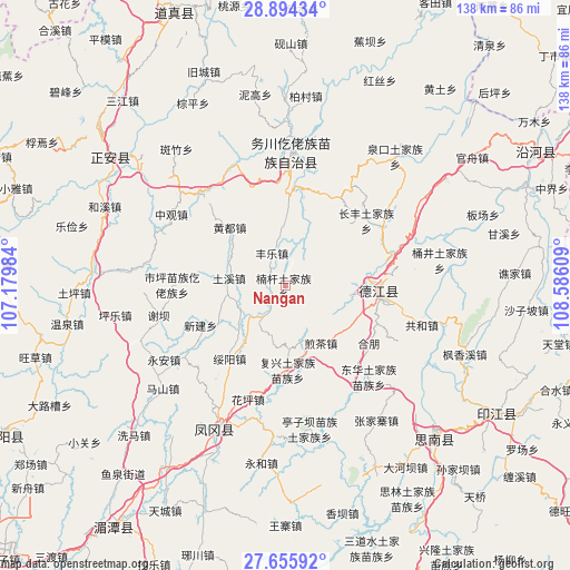
Nangan GPS coordinates[2]
28° 16' 36.948" North, 107° 52' 58.656" East
| Map corner | latitude | longitude |
|---|---|---|
| Upper-left | 28.89434°, | 107.17984° |
| Center: | 28.27693°, | 107.88296° |
| Lower-right: | 27.65592°, | 108.58609° |
| Map W x H: | 137.7×137.7 km | = 85.6×85.6mi |
| max Lat: | 53.31946° ⇑71.7% North |
| Nangan: | 28.27693° |
| min Lat: | ⇓28.3% South 18.22056° |
| min Long | Nangan | max Long |
| 75.07348° | 107.88296° | 134.28917° |
| W 19%⇐ | ⇒81% E |
Elevation
Elevation of Nangan is 770 m = 2526 ft, and this is 285.2 m = 936 ft above average elevation for this country.
| Max E: |
5622 m = 18445 ft | 18.4% |
| Nangan | 770 m 2526 ft | |
| Avg. | 484.8 m = 1591 ft | |
Min E: |
-3 m = -10 ft | 81.6% |
See also: China elevation on elevation.city.
Geographical zone
Nangan is located in North temperate zone (between Tropic of Cancer and the Arctic Circle). Distance of this Northern Tropic circle is 538.2 km =334.4 mi to South.| Distance of | km | miles | from Nangan |
|---|---|---|---|
| North Pole | 6863 | 4264.5 | to North |
| Arctic Circle | 4257.1 | 2645.2 | to North |
| Tropic Cancer | 538.2 | 334.4 | to South |
| Equator | 3144.1 | 1953.7 | to South |


Nearby cities:
15 places around Nangan: (largest is in red/bold)
• Changfeng
25.4 km =15.8 mi,  50°
50°
• Fengle
8.6 km =5.3 mi,  340°
340°
• Fuxing
20.4 km =12.7 mi,  178°
178°
• Huangdu
19.5 km =12.1 mi,  315°
315°
• Jiancha
16.7 km =10.4 mi,  148°
148°
• Longquan
15.4 km =9.6 mi,  98°
98°
• Pingyuan
14.1 km =8.8 mi,  193°
193°
• Qianjia
19 km =11.8 mi,  83°
83°
• Qinglong
22.5 km =14 mi,  93°
93°
• Shaxi
11.3 km =7 mi,  66°
66°
• Shichao
21.3 km =13.2 mi, 46°
• Suiyang
22.3 km =13.9 mi,  217°
217°
• Tuxi
13.2 km =8.2 mi,  280°
280°
• Xinjian
22.7 km =14.1 mi,  244°
244°
• Yantang
22.6 km =14 mi,  105°
105°
Sources, notices
• [Note1] Compared only with cities in China existing in our database
• [Src1] Map data: © OpenStreetMap contributors (CC-BY-SA)
• [Src2] Other city data from geonames.org with taken over terms of usage.
• [Src3] Geographical zone / Annual Mean Temperature by Robert A. Rohde @ Wikipedia
