Dongshanba geodata
Dongshanba (Jiangxi) is a seat of a fourth-order administrative division; located in China in Asia/Shanghai (GMT+8) time zone. In our database, there are 1268 cities with bigger population. Compared to other cities in China, 79.6% of cities are located further ↑North; 60.4% of cities are located further ←West and 56% of cities have lower elevation than Dongshanba. Note1


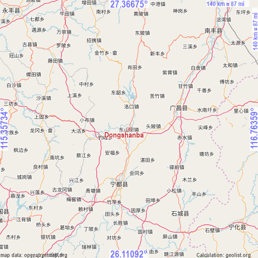
Dongshanba GPS coordinates[2]
26° 44' 26.052" North, 116° 3' 37.656" East
| Map corner | latitude | longitude |
|---|---|---|
| Upper-left | 27.36675°, | 115.35734° |
| Center: | 26.74057°, | 116.06046° |
| Lower-right: | 26.11092°, | 116.76359° |
| Map W x H: | 139.6×139.6 km | = 86.7×86.7mi |
| max Lat: | 53.31946° ⇑79.6% North |
| Dongshanba: | 26.74057° |
| min Lat: | ⇓20.4% South 18.22056° |
| min Long | Dongshanba | max Long |
| 75.07348° | 116.06046° | 134.28917° |
| W 60.4%⇐ | ⇒39.6% E |
Elevation
Elevation of Dongshanba is 216 m = 709 ft, and this is 268.8 m = 882 ft below average elevation for this country.
| Max E: |
5622 m = 18445 ft | 44% |
| Avg. | 484.8 m = 1591 ft | |
| Dongshanba | 216 m = 709 ft | |
Min E: |
-3 m = -10 ft | 56% |
See also: China elevation on elevation.city.
Geographical zone
Dongshanba is located in North temperate zone (between Tropic of Cancer and the Arctic Circle). Distance of this Northern Tropic circle is 367.4 km =228.3 mi to South.| Distance of | km | miles | from Dongshanba |
|---|---|---|---|
| North Pole | 7033.8 | 4370.6 | to North |
| Arctic Circle | 4427.9 | 2751.4 | to North |
| Tropic Cancer | 367.4 | 228.3 | to South |
| Equator | 2973.3 | 1847.5 | to South |


Nearby cities:
15 places around Dongshanba: (largest is in red/bold)
• Anfu
15.5 km =9.6 mi,  215°
215°
• Caijiang
28.3 km =17.6 mi,  240°
240°
• Dagu
27.2 km =16.9 mi,  268°
268°
• Diaofeng
13.4 km =8.3 mi,  261°
261°
• Dongshao
22.9 km =14.2 mi,  345°
345°
• Huangbei
21.7 km =13.5 mi, 255°
• Huitong
24 km =14.9 mi,  169°
169°
• Kuzhu
23.5 km =14.6 mi,  39°
39°
• Luokou
12.6 km =7.8 mi,  4°
4°
• Meijiang
29.8 km =18.5 mi,  188°
188°
• Shishang
12.9 km =8 mi,  181°
181°
• Toupi
13.2 km =8.2 mi,  82°
82°
• Xiaobu
23.3 km =14.5 mi,  282°
282°
• Xujiang
28 km =17.4 mi,  66°
66°
• Zhantian
19.3 km =12 mi,  148°
148°
Sources, notices
• [Note1] Compared only with cities in China existing in our database
• [Src1] Map data: © OpenStreetMap contributors (CC-BY-SA)
• [Src2] Other city data from geonames.org with taken over terms of usage.
• [Src3] Geographical zone / Annual Mean Temperature by Robert A. Rohde @ Wikipedia
