Xindian geodata
Xindian (Henan) is a seat of a fourth-order administrative division; located in China in Asia/Shanghai (GMT+8) time zone. In our database, there are 1268 cities with bigger population. Compared to other cities in China, 68.4% of cities are located further ↓South; 52.3% of cities are located further →East and 66.1% of cities have higher elevation than Xindian. Note1


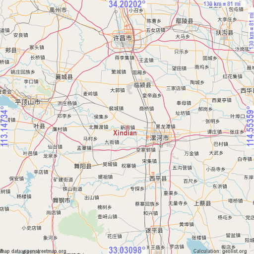
Xindian GPS coordinates[2]
33° 37' 6.564" North, 113° 51' 1.656" East
| Map corner | latitude | longitude |
|---|---|---|
| Upper-left | 34.20202°, | 113.14734° |
| Center: | 33.61849°, | 113.85046° |
| Lower-right: | 33.03098°, | 114.55359° |
| Map W x H: | 130.2×130.2 km | = 80.9×80.9mi |
| max Lat: | 53.31946° ⇑31.6% North |
| Xindian: | 33.61849° |
| min Lat: | ⇓68.4% South 18.22056° |
| min Long | Xindian | max Long |
| 75.07348° | 113.85046° | 134.28917° |
| W 47.7%⇐ | ⇒52.3% E |
Elevation
Elevation of Xindian is 68 m = 223 ft, and this is 416.8 m = 1367 ft below average elevation for this country.
| Max E: |
5622 m = 18445 ft | 66.1% |
| Avg. | 484.8 m = 1591 ft | |
| Xindian | 68 m = 223 ft | |
Min E: |
-3 m = -10 ft | 33.9% |
See also: China elevation on elevation.city.
Geographical zone
Xindian is located in North temperate zone (between Tropic of Cancer and the Arctic Circle). Distance of this Northern Tropic circle is 1132.1 km =703.5 mi to South.| Distance of | km | miles | from Xindian |
|---|---|---|---|
| North Pole | 6269 | 3895.4 | to North |
| Arctic Circle | 3663.1 | 2276.1 | to North |
| Tropic Cancer | 1132.1 | 703.5 | to South |
| Equator | 3738 | 2322.7 | to South |


Nearby cities:
15 places around Xindian: (largest is in red/bold)
• Beiwudu
14.7 km =9.1 mi,  271°
271°
• Daliu
13.7 km =8.5 mi,  159°
159°
• Ganhechen
17.1 km =10.6 mi,  113°
113°
• Houji
14.6 km =9.1 mi,  293°
293°
• Jiujie
10.9 km =6.8 mi,  226°
226°
• Lianhua
3.7 km =2.3 mi, 230°
• Longcheng
6.1 km =3.8 mi,  101°
101°
• Luohe
18.8 km =11.7 mi, 108°
• Macun
19.8 km =12.3 mi,  253°
253°
• Peicheng
11.4 km =7.1 mi,  330°
330°
• Quanzhai
19.6 km =12.2 mi,  177°
177°
• Shangqiao
13.8 km =8.6 mi,  45°
45°
• Taichen
18 km =11.2 mi,  21°
21°
• Taiwei
8.7 km =5.4 mi,  278°
278°
• Yancheng Chengguanzhen
13.2 km =8.2 mi, 106°
Sources, notices
• [Note1] Compared only with cities in China existing in our database
• [Src1] Map data: © OpenStreetMap contributors (CC-BY-SA)
• [Src2] Other city data from geonames.org with taken over terms of usage.
• [Src3] Geographical zone / Annual Mean Temperature by Robert A. Rohde @ Wikipedia
