Darenzhuang geodata
Darenzhuang (Tianjin) is a populated place; located in China in Asia/Shanghai (GMT+8) time zone. With population of 3,950 people, there are 898 cities with bigger population in this country. Compared to other cities in China, 82.9% of cities are located further ↓South; 67.5% of cities are located further ←West and 97.2% of cities have higher elevation than Darenzhuang. Note1


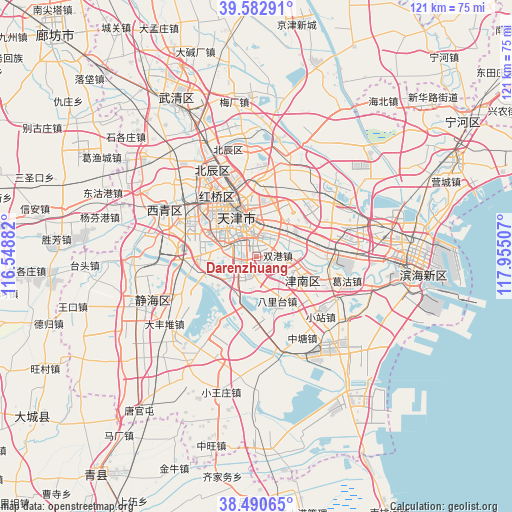
Darenzhuang GPS coordinates[2]
39° 2' 20.004" North, 117° 15' 6.984" East
| Map corner | latitude | longitude |
|---|---|---|
| Upper-left | 39.58291°, | 116.54882° |
| Center: | 39.03889°, | 117.25194° |
| Lower-right: | 38.49065°, | 117.95507° |
| Map W x H: | 121.4×121.4 km | = 75.4×75.4mi |
| max Lat: | 53.31946° ⇑17.1% North |
| Darenzhuang: | 39.03889° |
| min Lat: | ⇓82.9% South 18.22056° |
| min Long | Darenzhuang | max Long |
| 75.07348° | 117.25194° | 134.28917° |
| W 67.5%⇐ | ⇒32.5% E |
Elevation
Elevation of Darenzhuang is 5 m = 16 ft, and this is 479.8 m = 1574 ft below average elevation for this country.
| Max E: |
5622 m = 18445 ft | 97.2% |
| Avg. | 484.8 m = 1591 ft | |
| Darenzhuang | 5 m = 16 ft | |
Min E: |
-3 m = -10 ft | 2.8% |
See also: China elevation on elevation.city.
Geographical zone
Darenzhuang is located in North temperate zone (between Tropic of Cancer and the Arctic Circle). Distance of this Northern Tropic circle is 1734.8 km =1078 mi to South.| Distance of | km | miles | from Darenzhuang |
|---|---|---|---|
| North Pole | 5666.3 | 3520.9 | to North |
| Arctic Circle | 3060.5 | 1901.7 | to North |
| Tropic Cancer | 1734.8 | 1078 | to South |
| Equator | 4340.7 | 2697.2 | to South |


Nearby cities:
15 places around Darenzhuang: (largest is in red/bold)
• Chentangzhuang
3.2 km =2 mi,  11°
11°
• Cuijiamatou
5.8 km =3.6 mi,  46°
46°
• Dasi
2.6 km =1.6 mi,  208°
208°
• Donghai
1.5 km =0.9 mi,  343°
343°
• Erhaoqiao
7.2 km =4.5 mi,  27°
27°
• Fuminlu
5.5 km =3.4 mi,  359°
359°
• Guajiasi
6.2 km =3.9 mi, 339°
• Jianshan
5.9 km =3.7 mi, 335°
• Liulin
3 km =1.9 mi,  22°
22°
• Shuanggang
5.1 km =3.2 mi,  83°
83°
• Taoyuan
6.8 km =4.2 mi, 338°
• Youyilu
6.3 km =3.9 mi,  312°
312°
• Yuexiulu
6.3 km =3.9 mi, 336°
• Zhangguizhuang
7.4 km =4.6 mi,  39°
39°
• Zhongshanmen
6.9 km =4.3 mi, 9°
Sources, notices
• [Note1] Compared only with cities in China existing in our database
• [Src1] Map data: © OpenStreetMap contributors (CC-BY-SA)
• [Src2] Other city data from geonames.org with taken over terms of usage.
• [Src3] Geographical zone / Annual Mean Temperature by Robert A. Rohde @ Wikipedia
