Guan’er geodata
Guan’er (Shanxi) is a seat of a fourth-order administrative division; located in China in Asia/Shanghai (GMT+8) time zone. In our database, there are 1268 cities with bigger population. Compared to other cities in China, 84.7% of cities are located further ↓South; 53.5% of cities are located further →East and 92% of cities have lower elevation than Guan’er. Note1


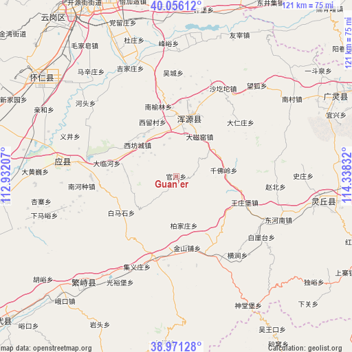
Guan’er GPS coordinates[2]
39° 30' 56.952" North, 113° 38' 6.684" East
| Map corner | latitude | longitude |
|---|---|---|
| Upper-left | 40.05612°, | 112.93207° |
| Center: | 39.51582°, | 113.63519° |
| Lower-right: | 38.97128°, | 114.33832° |
| Map W x H: | 120.6×120.6 km | = 74.9×74.9mi |
| max Lat: | 53.31946° ⇑15.3% North |
| Guan’er: | 39.51582° |
| min Lat: | ⇓84.7% South 18.22056° |
| min Long | Guan’er | max Long |
| 75.07348° | 113.63519° | 134.28917° |
| W 46.5%⇐ | ⇒53.5% E |
Elevation
Elevation of Guan’er is 1571 m = 5154 ft, and this is 1086.2 m = 3564 ft above average elevation for this country.
| Max E: |
5622 m = 18445 ft | 8% |
| Guan’er | 1571 m 5154 ft | |
| Avg. | 484.8 m = 1591 ft | |
Min E: |
-3 m = -10 ft | 92% |
See also: China elevation on elevation.city.
Geographical zone
Guan’er is located in North temperate zone (between Tropic of Cancer and the Arctic Circle). Distance of this Northern Tropic circle is 1787.8 km =1110.9 mi to South.| Distance of | km | miles | from Guan’er |
|---|---|---|---|
| North Pole | 5613.3 | 3487.9 | to North |
| Arctic Circle | 3007.4 | 1868.7 | to North |
| Tropic Cancer | 1787.8 | 1110.9 | to South |
| Equator | 4393.7 | 2730.1 | to South |


Nearby cities:
15 places around Guan’er: (largest is in red/bold)
• Baijiazhuang
17.1 km =10.6 mi,  170°
170°
• Caicun
25.4 km =15.8 mi,  2°
2°
• Daciyao
15.8 km =9.8 mi,  30°
30°
• Dalinhe
23.9 km =14.9 mi,  280°
280°
• Huanghuatan
23.4 km =14.5 mi,  49°
49°
• Jinshanpu
24.9 km =15.5 mi, 171°
• Qianfoling
16.4 km =10.2 mi,  82°
82°
• Qingciyao
16.2 km =10.1 mi,  44°
44°
• Tuofeng
19.6 km =12.2 mi,  305°
305°
• Wangzhuangbu
25.1 km =15.6 mi,  110°
110°
• Xiahan
23.3 km =14.5 mi,  355°
355°
• Xifangcheng
17 km =10.6 mi, 309°
• Xiliu
20.3 km =12.6 mi,  336°
336°
• Xinpeicun
14.5 km =9 mi,  321°
321°
• Yong’an
20.5 km =12.7 mi,  12°
12°
Sources, notices
• [Note1] Compared only with cities in China existing in our database
• [Src1] Map data: © OpenStreetMap contributors (CC-BY-SA)
• [Src2] Other city data from geonames.org with taken over terms of usage.
• [Src3] Geographical zone / Annual Mean Temperature by Robert A. Rohde @ Wikipedia
