Changfeng geodata
Changfeng (Shaanxi) is a seat of a fourth-order administrative division; located in China in Asia/Shanghai (GMT+8) time zone. In our database, there are 1268 cities with bigger population. Compared to other cities in China, 74% of cities are located further ↓South; 80.7% of cities are located further →East and 87.8% of cities have lower elevation than Changfeng. Note1


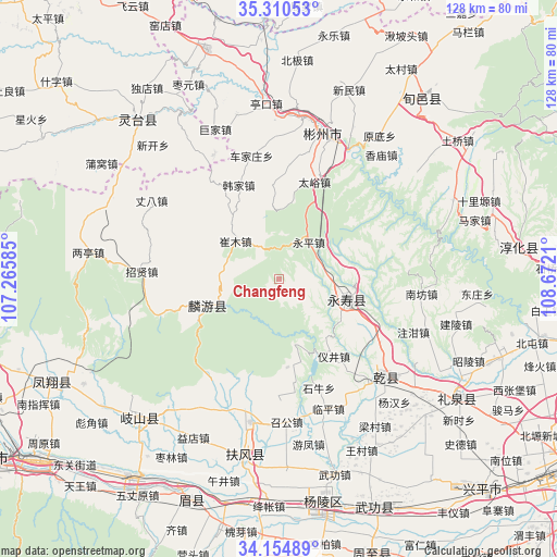
Changfeng GPS coordinates[2]
34° 44' 5.028" North, 107° 58' 8.292" East
| Map corner | latitude | longitude |
|---|---|---|
| Upper-left | 35.31053°, | 107.26585° |
| Center: | 34.73473°, | 107.96897° |
| Lower-right: | 34.15489°, | 108.6721° |
| Map W x H: | 128.5×128.5 km | = 79.8×79.8mi |
| max Lat: | 53.31946° ⇑26% North |
| Changfeng: | 34.73473° |
| min Lat: | ⇓74% South 18.22056° |
| min Long | Changfeng | max Long |
| 75.07348° | 107.96897° | 134.28917° |
| W 19.3%⇐ | ⇒80.7% E |
Elevation
Elevation of Changfeng is 1171 m = 3842 ft, and this is 686.2 m = 2251 ft above average elevation for this country.
| Max E: |
5622 m = 18445 ft | 12.2% |
| Changfeng | 1171 m 3842 ft | |
| Avg. | 484.8 m = 1591 ft | |
Min E: |
-3 m = -10 ft | 87.8% |
See also: China elevation on elevation.city.
Geographical zone
Changfeng is located in North temperate zone (between Tropic of Cancer and the Arctic Circle). Distance of this Northern Tropic circle is 1256.2 km =780.6 mi to South.| Distance of | km | miles | from Changfeng |
|---|---|---|---|
| North Pole | 6144.9 | 3818.3 | to North |
| Arctic Circle | 3539 | 2199 | to North |
| Tropic Cancer | 1256.2 | 780.6 | to South |
| Equator | 3862.1 | 2399.8 | to South |


Nearby cities:
15 places around Changfeng: (largest is in red/bold)
• Cuimu
13.1 km =8.1 mi,  310°
310°
• Didian
21.4 km =13.3 mi,  356°
356°
• Duma
15.5 km =9.6 mi,  77°
77°
• Ganjing
8.8 km =5.5 mi,  100°
100°
• Guantou
12.9 km =8 mi,  131°
131°
• Hanjia
23.4 km =14.5 mi,  336°
336°
• Jianjun
16.3 km =10.1 mi,  107°
107°
• Jiuchenggong
17.7 km =11 mi,  249°
249°
• Mafang
18.6 km =11.6 mi,  72°
72°
• Pingyao
10.4 km =6.5 mi,  2°
2°
• Sangshuyuan
13.7 km =8.5 mi,  269°
269°
• Taiyu
23.5 km =14.6 mi,  20°
20°
• Yijing
21.9 km =13.6 mi,  145°
145°
• Yongping
10.7 km =6.6 mi,  38°
38°
• Yujiagong
20 km =12.4 mi,  91°
91°
Sources, notices
• [Note1] Compared only with cities in China existing in our database
• [Src1] Map data: © OpenStreetMap contributors (CC-BY-SA)
• [Src2] Other city data from geonames.org with taken over terms of usage.
• [Src3] Geographical zone / Annual Mean Temperature by Robert A. Rohde @ Wikipedia
