Zhaobaoshan geodata
Zhaobaoshan (Zhejiang) is a seat of a third-order administrative division; located in China in Asia/Shanghai (GMT+8) time zone. With population of 61,979 people, there are 698 cities with bigger population in this country. Compared to other cities in China, 54.4% of cities are located further ↑North; 90.6% of cities are located further ←West and 98.9% of cities have higher elevation than Zhaobaoshan. Note1


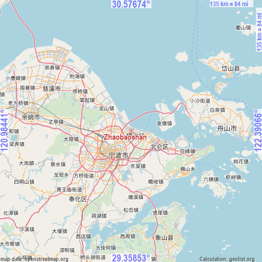
Zhaobaoshan GPS coordinates[2]
29° 58' 10.2" North, 121° 41' 15.108" East
| Map corner | latitude | longitude |
|---|---|---|
| Upper-left | 30.57674°, | 120.98441° |
| Center: | 29.9695°, | 121.68753° |
| Lower-right: | 29.35853°, | 122.39066° |
| Map W x H: | 135.5×135.5 km | = 84.2×84.2mi |
| max Lat: | 53.31946° ⇑54.4% North |
| Zhaobaoshan: | 29.9695° |
| min Lat: | ⇓45.6% South 18.22056° |
| min Long | Zhaobaoshan | max Long |
| 75.07348° | 121.68753° | 134.28917° |
| W 90.6%⇐ | ⇒9.4% E |
Elevation
Elevation of Zhaobaoshan is 3 m = 10 ft, and this is 481.8 m = 1581 ft below average elevation for this country.
| Max E: |
5622 m = 18445 ft | 98.9% |
| Avg. | 484.8 m = 1591 ft | |
| Zhaobaoshan | 3 m = 10 ft | |
Min E: |
-3 m = -10 ft | 1.1% |
See also: Zhaobaoshan elevation on elevation.city.
Geographical zone
Zhaobaoshan is located in North temperate zone (between Tropic of Cancer and the Arctic Circle). Distance of this Northern Tropic circle is 726.4 km =451.4 mi to South.| Distance of | km | miles | from Zhaobaoshan |
|---|---|---|---|
| North Pole | 6674.8 | 4147.5 | to North |
| Arctic Circle | 4068.9 | 2528.3 | to North |
| Tropic Cancer | 726.4 | 451.4 | to South |
| Equator | 3332.3 | 2070.6 | to South |


Nearby cities:
15 places around Zhaobaoshan: (largest is in red/bold)
• Beilun
15.5 km =9.6 mi,  111°
111°
• Daqi
13.5 km =8.4 mi,  129°
129°
• Dongjiao
14.3 km =8.9 mi,  222°
222°
• Fuming
13.5 km =8.4 mi, 217°
• Hongtang
17.6 km =10.9 mi,  263°
263°
• Jiulonghu
14.7 km =9.1 mi,  303°
303°
• Luotuo
9.5 km =5.9 mi,  280°
280°
• Ningbo
16.7 km =10.4 mi,  232°
232°
• Qiu’ai
14.1 km =8.8 mi,  202°
202°
• Wuxiang
13.7 km =8.5 mi,  180°
180°
• Xiaogang
5.7 km =3.5 mi, 111°
• Xiepu
10.9 km =6.8 mi, 304°
• Yongjiang
12.8 km =8 mi,  235°
235°
• Zhuangqiao
14.1 km =8.8 mi,  251°
251°
• Zhuangshi
8.5 km =5.3 mi, 241°
Sources, notices
• [Note1] Compared only with cities in China existing in our database
• [Src1] Map data: © OpenStreetMap contributors (CC-BY-SA)
• [Src2] Other city data from geonames.org with taken over terms of usage.
• [Src3] Geographical zone / Annual Mean Temperature by Robert A. Rohde @ Wikipedia
