Baojia geodata
Baojia (Chongqing) is a seat of a fourth-order administrative division; located in China in Asia/Shanghai (GMT+8) time zone. In our database, there are 1268 cities with bigger population. Compared to other cities in China, 60.5% of cities are located further ↑North; 79.4% of cities are located further →East and 64.1% of cities have lower elevation than Baojia. Note1


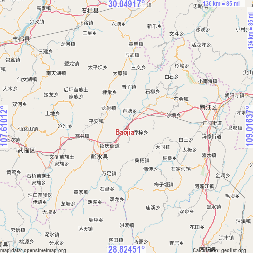
Baojia GPS coordinates[2]
29° 26' 19.284" North, 108° 18' 47.664" East
| Map corner | latitude | longitude |
|---|---|---|
| Upper-left | 30.04917°, | 107.61012° |
| Center: | 29.43869°, | 108.31324° |
| Lower-right: | 28.82451°, | 109.01637° |
| Map W x H: | 136.2×136.2 km | = 84.6×84.6mi |
| max Lat: | 53.31946° ⇑60.5% North |
| Baojia: | 29.43869° |
| min Lat: | ⇓39.5% South 18.22056° |
| min Long | Baojia | max Long |
| 75.07348° | 108.31324° | 134.28917° |
| W 20.6%⇐ | ⇒79.4% E |
Elevation
Elevation of Baojia is 311 m = 1020 ft, and this is 173.8 m = 570 ft below average elevation for this country.
| Max E: |
5622 m = 18445 ft | 35.9% |
| Avg. | 484.8 m = 1591 ft | |
| Baojia | 311 m = 1020 ft | |
Min E: |
-3 m = -10 ft | 64.1% |
See also: China elevation on elevation.city.
Geographical zone
Baojia is located in North temperate zone (between Tropic of Cancer and the Arctic Circle). Distance of this Northern Tropic circle is 667.4 km =414.7 mi to South.| Distance of | km | miles | from Baojia |
|---|---|---|---|
| North Pole | 6733.8 | 4184.2 | to North |
| Arctic Circle | 4127.9 | 2565 | to North |
| Tropic Cancer | 667.4 | 414.7 | to South |
| Equator | 3273.3 | 2033.9 | to South |


Nearby cities:
15 places around Baojia: (largest is in red/bold)
• Changtan
13.6 km =8.5 mi,  221°
221°
• Ditang
20.7 km =12.9 mi,  333°
333°
• Hanjia
21.7 km =13.5 mi, 222°
• Lianhe
20.4 km =12.7 mi,  32°
32°
• Longshe
14.2 km =8.8 mi,  316°
316°
• Longxi
19.9 km =12.4 mi,  80°
80°
• Lutang
9 km =5.6 mi,  10°
10°
• Ping’an
16.7 km =10.4 mi,  280°
280°
• Puzi
21.6 km =13.4 mi,  3°
3°
• Qianqiao
9.3 km =5.8 mi,  176°
176°
• Qiaozi
8.1 km =5 mi,  111°
111°
• Sangzhe
19.6 km =12.2 mi,  155°
155°
• Xiaochang
22 km =13.7 mi,  118°
118°
• Yandong
18.5 km =11.5 mi,  203°
203°
• Yushan
15.1 km =9.4 mi,  45°
45°
Sources, notices
• [Note1] Compared only with cities in China existing in our database
• [Src1] Map data: © OpenStreetMap contributors (CC-BY-SA)
• [Src2] Other city data from geonames.org with taken over terms of usage.
• [Src3] Geographical zone / Annual Mean Temperature by Robert A. Rohde @ Wikipedia
