Baima geodata
Baima (Gansu) is a seat of a fourth-order administrative division; located in China in Asia/Shanghai (GMT+8) time zone. In our database, there are 1268 cities with bigger population. Compared to other cities in China, 78.4% of cities are located further ↓South; 81.5% of cities are located further →East and 89.5% of cities have lower elevation than Baima. Note1


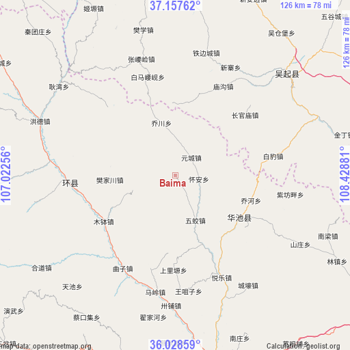
Baima GPS coordinates[2]
36° 35' 42.612" North, 107° 43' 32.448" East
| Map corner | latitude | longitude |
|---|---|---|
| Upper-left | 37.15762°, | 107.02256° |
| Center: | 36.59517°, | 107.72568° |
| Lower-right: | 36.02859°, | 108.42881° |
| Map W x H: | 125.5×125.5 km | = 78×78mi |
| max Lat: | 53.31946° ⇑21.6% North |
| Baima: | 36.59517° |
| min Lat: | ⇓78.4% South 18.22056° |
| min Long | Baima | max Long |
| 75.07348° | 107.72568° | 134.28917° |
| W 18.5%⇐ | ⇒81.5% E |
Elevation
Elevation of Baima is 1317 m = 4321 ft, and this is 832.2 m = 2730 ft above average elevation for this country.
| Max E: |
5622 m = 18445 ft | 10.5% |
| Baima | 1317 m 4321 ft | |
| Avg. | 484.8 m = 1591 ft | |
Min E: |
-3 m = -10 ft | 89.5% |
See also: China elevation on elevation.city.
Geographical zone
Baima is located in North temperate zone (between Tropic of Cancer and the Arctic Circle). Distance of this Northern Tropic circle is 1463.1 km =909.1 mi to South.| Distance of | km | miles | from Baima |
|---|---|---|---|
| North Pole | 5938.1 | 3689.8 | to North |
| Arctic Circle | 3332.2 | 2070.5 | to North |
| Tropic Cancer | 1463.1 | 909.1 | to South |
| Equator | 4069 | 2528.4 | to South |


Nearby cities:
15 places around Baima: (largest is in red/bold)
• Bazhu
14.2 km =8.8 mi,  251°
251°
• Fanjiachuan
23.7 km =14.7 mi,  265°
265°
• Huai’an
8.4 km =5.2 mi,  98°
98°
• Huancheng
38.4 km =23.9 mi, 266°
• Liliangzi
25.2 km =15.7 mi,  160°
160°
• Miaogou
36 km =22.4 mi,  28°
28°
• Miaoxiang
24.5 km =15.2 mi,  107°
107°
• Mubo
30.7 km =19.1 mi,  237°
237°
• Qiaochuan
19.4 km =12.1 mi,  345°
345°
• Rouyuan
27.4 km =17 mi,  122°
122°
• Shangliyuan
34.2 km =21.3 mi,  181°
181°
• Wentai
30.3 km =18.8 mi,  147°
147°
• Wujiao
17.7 km =11 mi, 156°
• Xujiahe
30.4 km =18.9 mi,  202°
202°
• Yuancheng
8.5 km =5.3 mi,  42°
42°
Sources, notices
• [Note1] Compared only with cities in China existing in our database
• [Src1] Map data: © OpenStreetMap contributors (CC-BY-SA)
• [Src2] Other city data from geonames.org with taken over terms of usage.
• [Src3] Geographical zone / Annual Mean Temperature by Robert A. Rohde @ Wikipedia
