Anmenkou geodata
Anmenkou (Gansu) is a seat of a fourth-order administrative division; located in China in Asia/Shanghai (GMT+8) time zone. In our database, there are 1268 cities with bigger population. Compared to other cities in China, 67.3% of cities are located further ↓South; 88% of cities are located further →East and 88.9% of cities have lower elevation than Anmenkou. Note1


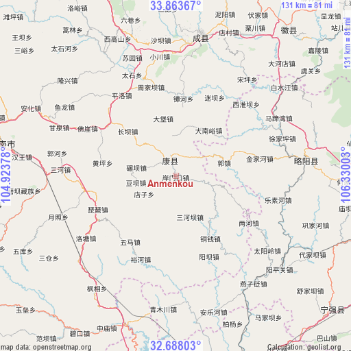
Anmenkou GPS coordinates[2]
33° 16' 40.188" North, 105° 37' 36.84" East
| Map corner | latitude | longitude |
|---|---|---|
| Upper-left | 33.86367°, | 104.92378° |
| Center: | 33.27783°, | 105.6269° |
| Lower-right: | 32.68803°, | 106.33003° |
| Map W x H: | 130.7×130.7 km | = 81.2×81.2mi |
| max Lat: | 53.31946° ⇑32.7% North |
| Anmenkou: | 33.27783° |
| min Lat: | ⇓67.3% South 18.22056° |
| min Long | Anmenkou | max Long |
| 75.07348° | 105.6269° | 134.28917° |
| W 12%⇐ | ⇒88% E |
Elevation
Elevation of Anmenkou is 1258 m = 4127 ft, and this is 773.2 m = 2537 ft above average elevation for this country.
| Max E: |
5622 m = 18445 ft | 11.1% |
| Anmenkou | 1258 m 4127 ft | |
| Avg. | 484.8 m = 1591 ft | |
Min E: |
-3 m = -10 ft | 88.9% |
See also: China elevation on elevation.city.
Geographical zone
Anmenkou is located in North temperate zone (between Tropic of Cancer and the Arctic Circle). Distance of this Northern Tropic circle is 1094.2 km =679.9 mi to South.| Distance of | km | miles | from Anmenkou |
|---|---|---|---|
| North Pole | 6306.9 | 3918.9 | to North |
| Arctic Circle | 3701 | 2299.7 | to North |
| Tropic Cancer | 1094.2 | 679.9 | to South |
| Equator | 3700.1 | 2299.1 | to South |


Nearby cities:
15 places around Anmenkou: (largest is in red/bold)
• Baiyang
18.5 km =11.5 mi,  128°
128°
• Dabao
21.9 km =13.6 mi,  347°
347°
• Dananyu
21 km =13 mi,  35°
35°
• Dianzi
13.3 km =8.3 mi,  241°
241°
• Douba
14.9 km =9.3 mi,  261°
261°
• Gongji
21.4 km =13.3 mi,  333°
333°
• Guozhen
19.2 km =11.9 mi,  73°
73°
• Jia’an
9.1 km =5.7 mi,  101°
101°
• Nianba
15 km =9.3 mi,  282°
282°
• Sanguan
8.9 km =5.5 mi, 345°
• Sanheba
16 km =9.9 mi,  160°
160°
• Sitai
23.2 km =14.4 mi,  356°
356°
• Yangtian
11 km =6.8 mi, 161°
• Yuntai
19.1 km =11.9 mi,  10°
10°
• Zuitai
6.2 km =3.9 mi,  340°
340°
Sources, notices
• [Note1] Compared only with cities in China existing in our database
• [Src1] Map data: © OpenStreetMap contributors (CC-BY-SA)
• [Src2] Other city data from geonames.org with taken over terms of usage.
• [Src3] Geographical zone / Annual Mean Temperature by Robert A. Rohde @ Wikipedia
