Fengcheng geodata
Fengcheng (Shanxi) is a seat of a fourth-order administrative division; located in China in Asia/Shanghai (GMT+8) time zone. In our database, there are 1268 cities with bigger population. Compared to other cities in China, 76.4% of cities are located further ↓South; 65.3% of cities are located further →East and 71.4% of cities have lower elevation than Fengcheng. Note1


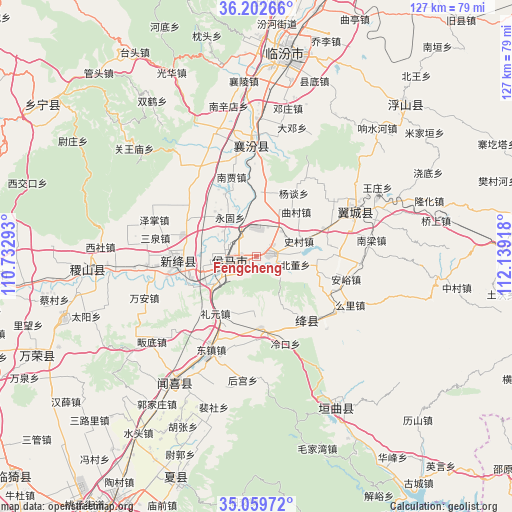
Fengcheng GPS coordinates[2]
35° 37' 59.628" North, 111° 26' 9.78" East
| Map corner | latitude | longitude |
|---|---|---|
| Upper-left | 36.20266°, | 110.73293° |
| Center: | 35.63323°, | 111.43605° |
| Lower-right: | 35.05972°, | 112.13918° |
| Map W x H: | 127.1×127.1 km | = 79×79mi |
| max Lat: | 53.31946° ⇑23.6% North |
| Fengcheng: | 35.63323° |
| min Lat: | ⇓76.4% South 18.22056° |
| min Long | Fengcheng | max Long |
| 75.07348° | 111.43605° | 134.28917° |
| W 34.7%⇐ | ⇒65.3% E |
Elevation
Elevation of Fengcheng is 439 m = 1440 ft, and this is 45.8 m = 150 ft below average elevation for this country.
| Max E: |
5622 m = 18445 ft | 28.6% |
| Avg. | 484.8 m = 1591 ft | |
| Fengcheng | 439 m = 1440 ft | |
Min E: |
-3 m = -10 ft | 71.4% |
See also: China elevation on elevation.city.
Geographical zone
Fengcheng is located in North temperate zone (between Tropic of Cancer and the Arctic Circle). Distance of this Northern Tropic circle is 1356.1 km =842.6 mi to South.| Distance of | km | miles | from Fengcheng |
|---|---|---|---|
| North Pole | 6045 | 3756.2 | to North |
| Arctic Circle | 3439.1 | 2137 | to North |
| Tropic Cancer | 1356.1 | 842.6 | to South |
| Equator | 3962 | 2461.9 | to South |


Nearby cities:
15 places around Fengcheng: (largest is in red/bold)
• Beidong
9.8 km =6.1 mi,  101°
101°
• Donggaocun
13.5 km =8.4 mi,  255°
255°
• Gaoxian
9.6 km =6 mi,  351°
351°
• Gujiang
18.8 km =11.7 mi,  145°
145°
• Lechang
3 km =1.9 mi,  70°
70°
• Licun
14.3 km =8.9 mi,  6°
6°
• Liyuan
17.4 km =10.8 mi,  215°
215°
• Longxing
19.7 km =12.2 mi, 263°
• Qucun
14.9 km =9.3 mi,  41°
41°
• Shangma
9.8 km =6.1 mi,  240°
240°
• Xintian
7.5 km =4.7 mi,  253°
253°
• Yangtan
18.3 km =11.4 mi,  30°
30°
• Yonggu
11.8 km =7.3 mi,  326°
326°
• Zhangcun
8 km =5 mi,  283°
283°
• Zhaokang
19.6 km =12.2 mi,  299°
299°
Sources, notices
• [Note1] Compared only with cities in China existing in our database
• [Src1] Map data: © OpenStreetMap contributors (CC-BY-SA)
• [Src2] Other city data from geonames.org with taken over terms of usage.
• [Src3] Geographical zone / Annual Mean Temperature by Robert A. Rohde @ Wikipedia
