Wenshan geodata
Wenshan (Zhejiang) is a seat of a fourth-order administrative division; located in China in Asia/Shanghai (GMT+8) time zone. In our database, there are 1268 cities with bigger population. Compared to other cities in China, 64% of cities are located further ↑North; 72.3% of cities are located further ←West and 50.3% of cities have higher elevation than Wenshan. Note1


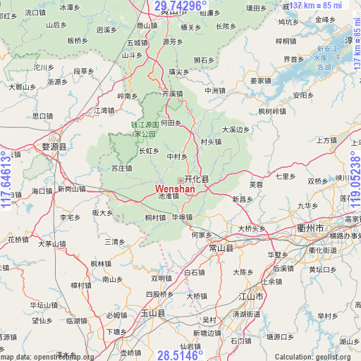
Wenshan GPS coordinates[2]
29° 7' 50.196" North, 118° 20' 57.3" East
| Map corner | latitude | longitude |
|---|---|---|
| Upper-left | 29.74296°, | 117.64613° |
| Center: | 29.13061°, | 118.34925° |
| Lower-right: | 28.5146°, | 119.05238° |
| Map W x H: | 136.6×136.6 km | = 84.9×84.9mi |
| max Lat: | 53.31946° ⇑64% North |
| Wenshan: | 29.13061° |
| min Lat: | ⇓36% South 18.22056° |
| min Long | Wenshan | max Long |
| 75.07348° | 118.34925° | 134.28917° |
| W 72.3%⇐ | ⇒27.7% E |
Elevation
Elevation of Wenshan is 162 m = 531 ft, and this is 322.8 m = 1059 ft below average elevation for this country.
| Max E: |
5622 m = 18445 ft | 50.3% |
| Avg. | 484.8 m = 1591 ft | |
| Wenshan | 162 m = 531 ft | |
Min E: |
-3 m = -10 ft | 49.7% |
See also: China elevation on elevation.city.
Geographical zone
Wenshan is located in North temperate zone (between Tropic of Cancer and the Arctic Circle). Distance of this Northern Tropic circle is 633.1 km =393.4 mi to South.| Distance of | km | miles | from Wenshan |
|---|---|---|---|
| North Pole | 6768 | 4205.4 | to North |
| Arctic Circle | 4162.2 | 2586.3 | to North |
| Tropic Cancer | 633.1 | 393.4 | to South |
| Equator | 3239 | 2012.6 | to South |


Nearby cities:
15 places around Wenshan: (largest is in red/bold)
• Cuntou
18.9 km =11.7 mi,  37°
37°
• Fangcun
16.4 km =10.2 mi,  319°
319°
• Fengjia
14.3 km =8.9 mi,  153°
153°
• Huabu
12.5 km =7.8 mi,  180°
180°
• Jincun
13.2 km =8.2 mi,  64°
64°
• Kaihua Chengguanzhen
6 km =3.7 mi,  73°
73°
• Lujiawu
16.8 km =10.4 mi,  215°
215°
• Majin
20.2 km =12.6 mi,  17°
17°
• Qingshandi
6.8 km =4.2 mi,  140°
140°
• Shandi
15.2 km =9.4 mi,  34°
34°
• Xikou
14.5 km =9 mi,  83°
83°
• Xingkou
7.2 km =4.5 mi, 220°
• Yinkeng
9 km =5.6 mi, 32°
• Youxikou
14.8 km =9.2 mi,  267°
267°
• Zhangcun
9.9 km =6.2 mi,  352°
352°
Sources, notices
• [Note1] Compared only with cities in China existing in our database
• [Src1] Map data: © OpenStreetMap contributors (CC-BY-SA)
• [Src2] Other city data from geonames.org with taken over terms of usage.
• [Src3] Geographical zone / Annual Mean Temperature by Robert A. Rohde @ Wikipedia
