Fangcun geodata
Fangcun (Zhejiang) is a seat of a fourth-order administrative division; located in China in Asia/Shanghai (GMT+8) time zone. In our database, there are 1268 cities with bigger population. Compared to other cities in China, 62.8% of cities are located further ↑North; 71.6% of cities are located further ←West and 70% of cities have lower elevation than Fangcun. Note1


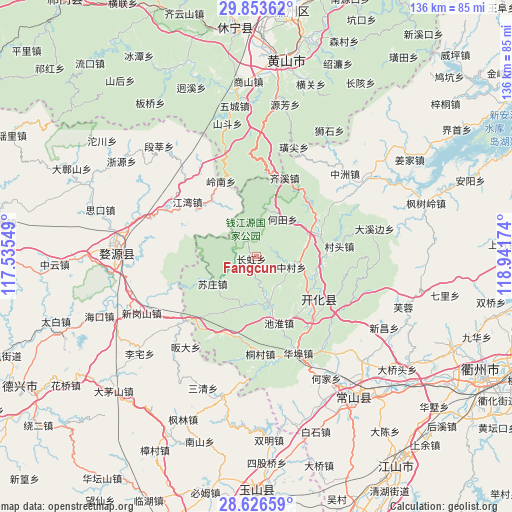
Fangcun GPS coordinates[2]
29° 14' 30.984" North, 118° 14' 18.996" East
| Map corner | latitude | longitude |
|---|---|---|
| Upper-left | 29.85362°, | 117.53549° |
| Center: | 29.24194°, | 118.23861° |
| Lower-right: | 28.62659°, | 118.94174° |
| Map W x H: | 136.4×136.4 km | = 84.8×84.8mi |
| max Lat: | 53.31946° ⇑62.8% North |
| Fangcun: | 29.24194° |
| min Lat: | ⇓37.2% South 18.22056° |
| min Long | Fangcun | max Long |
| 75.07348° | 118.23861° | 134.28917° |
| W 71.6%⇐ | ⇒28.4% E |
Elevation
Elevation of Fangcun is 411 m = 1348 ft, and this is 73.8 m = 242 ft below average elevation for this country.
| Max E: |
5622 m = 18445 ft | 30% |
| Avg. | 484.8 m = 1591 ft | |
| Fangcun | 411 m = 1348 ft | |
Min E: |
-3 m = -10 ft | 70% |
See also: China elevation on elevation.city.
Geographical zone
Fangcun is located in North temperate zone (between Tropic of Cancer and the Arctic Circle). Distance of this Northern Tropic circle is 645.5 km =401.1 mi to South.| Distance of | km | miles | from Fangcun |
|---|---|---|---|
| North Pole | 6755.7 | 4197.8 | to North |
| Arctic Circle | 4149.8 | 2578.6 | to North |
| Tropic Cancer | 645.5 | 401.1 | to South |
| Equator | 3251.4 | 2020.3 | to South |


Nearby cities:
15 places around Fangcun: (largest is in red/bold)
• Cuntou
22.4 km =13.9 mi,  83°
83°
• Dongkengkou
22.6 km =14 mi,  204°
204°
• Hejia
12.2 km =7.6 mi,  37°
37°
• Kaihua Chengguanzhen
19.7 km =12.2 mi,  122°
122°
• Majin
18.2 km =11.3 mi,  67°
67°
• Maotan
13.3 km =8.3 mi,  237°
237°
• Qingshandi
23.1 km =14.4 mi,  139°
139°
• Shandi
19.3 km =12 mi,  89°
89°
• Shichuan
23.2 km =14.4 mi,  342°
342°
• Wenshan
16.4 km =10.2 mi, 139°
• Xiashan
19.1 km =11.9 mi,  58°
58°
• Xingkou
18.8 km =11.7 mi,  161°
161°
• Yinkeng
16.3 km =10.1 mi,  107°
107°
• Youxikou
13.7 km =8.5 mi, 196°
• Zhangcun
9.7 km =6 mi, 105°
Sources, notices
• [Note1] Compared only with cities in China existing in our database
• [Src1] Map data: © OpenStreetMap contributors (CC-BY-SA)
• [Src2] Other city data from geonames.org with taken over terms of usage.
• [Src3] Geographical zone / Annual Mean Temperature by Robert A. Rohde @ Wikipedia
