Yonghe geodata
Yonghe (Guangdong) is a seat of a fourth-order administrative division; located in China in Asia/Shanghai (GMT+8) time zone. In our database, there are 1268 cities with bigger population. Compared to other cities in China, 93.6% of cities are located further ↑North; 53.8% of cities are located further →East and 91.2% of cities have higher elevation than Yonghe. Note1


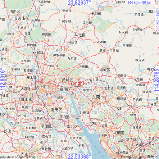
Yonghe GPS coordinates[2]
23° 10' 53.724" North, 113° 35' 4.992" East
| Map corner | latitude | longitude |
|---|---|---|
| Upper-left | 23.82637°, | 112.8816° |
| Center: | 23.18159°, | 113.58472° |
| Lower-right: | 22.53368°, | 114.28785° |
| Map W x H: | 143.7×143.7 km | = 89.3×89.3mi |
| max Lat: | 53.31946° ⇑93.6% North |
| Yonghe: | 23.18159° |
| min Lat: | ⇓6.4% South 18.22056° |
| min Long | Yonghe | max Long |
| 75.07348° | 113.58472° | 134.28917° |
| W 46.2%⇐ | ⇒53.8% E |
Elevation
Elevation of Yonghe is 9 m = 30 ft, and this is 475.8 m = 1561 ft below average elevation for this country.
| Max E: |
5622 m = 18445 ft | 91.2% |
| Avg. | 484.8 m = 1591 ft | |
| Yonghe | 9 m = 30 ft | |
Min E: |
-3 m = -10 ft | 8.8% |
See also: China elevation on elevation.city.
Geographical zone
Yonghe is located in North Torrid zone (between Equator and Tropic of Cancer). Distance of this Northern Tropic circle is 28.4 km =17.6 mi to North.| Distance of | km | miles | from Yonghe |
|---|---|---|---|
| North Pole | 7429.5 | 4616.5 | to North |
| Arctic Circle | 4823.6 | 2997.2 | to North |
| Tropic Cancer | 28.4 | 17.6 | to North |
| Equator | 2577.6 | 1601.6 | to South |


Nearby cities:
15 places around Yonghe: (largest is in red/bold)
• Dasha
16.6 km =10.3 mi,  241°
241°
• Gaobu
17.4 km =10.8 mi,  128°
128°
• Hongshan
15 km =9.3 mi,  234°
234°
• Lilian
8.5 km =5.3 mi,  211°
211°
• Luogang
8.6 km =5.3 mi,  267°
267°
• Mayong
14 km =8.7 mi,  187°
187°
• Nangang
10 km =6.2 mi, 206°
• Ningxi
8.2 km =5.1 mi,  61°
61°
• Suidong
13.4 km =8.3 mi,  216°
216°
• Wangniudun
15.7 km =9.8 mi,  155°
155°
• Xintang
7.8 km =4.8 mi, 161°
• Yuzhu
18.3 km =11.4 mi, 241°
• Zhongtang
11.8 km =7.3 mi,  145°
145°
• Zhongxin
12.2 km =7.6 mi,  13°
13°
• Zhucun
15.2 km =9.4 mi,  44°
44°
Sources, notices
• [Note1] Compared only with cities in China existing in our database
• [Src1] Map data: © OpenStreetMap contributors (CC-BY-SA)
• [Src2] Other city data from geonames.org with taken over terms of usage.
• [Src3] Geographical zone / Annual Mean Temperature by Robert A. Rohde @ Wikipedia
