Luogang geodata
Luogang (Guangdong) is a seat of a third-order administrative division; located in China in Asia/Shanghai (GMT+8) time zone. In our database, there are 1268 cities with bigger population. Compared to other cities in China, 93.6% of cities are located further ↑North; 54.3% of cities are located further →East and 83.4% of cities have higher elevation than Luogang. Note1


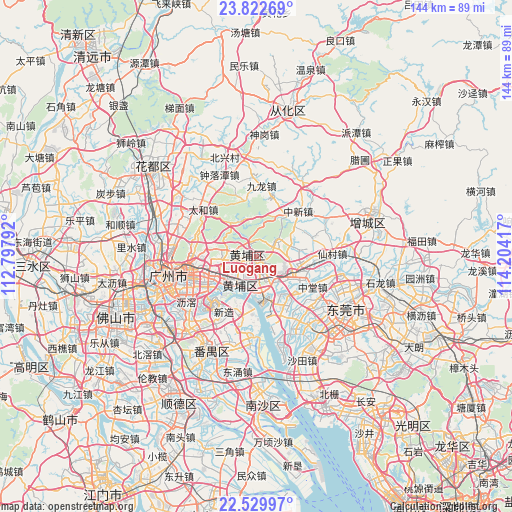
Luogang GPS coordinates[2]
23° 10' 40.404" North, 113° 30' 3.744" East
| Map corner | latitude | longitude |
|---|---|---|
| Upper-left | 23.82269°, | 112.79792° |
| Center: | 23.17789°, | 113.50104° |
| Lower-right: | 22.52997°, | 114.20417° |
| Map W x H: | 143.7×143.7 km | = 89.3×89.3mi |
| max Lat: | 53.31946° ⇑93.6% North |
| Luogang: | 23.17789° |
| min Lat: | ⇓6.4% South 18.22056° |
| min Long | Luogang | max Long |
| 75.07348° | 113.50104° | 134.28917° |
| W 45.7%⇐ | ⇒54.3% E |
Elevation
Elevation of Luogang is 19 m = 62 ft, and this is 465.8 m = 1528 ft below average elevation for this country.
| Max E: |
5622 m = 18445 ft | 83.4% |
| Avg. | 484.8 m = 1591 ft | |
| Luogang | 19 m = 62 ft | |
Min E: |
-3 m = -10 ft | 16.6% |
See also: China elevation on elevation.city.
Geographical zone
Luogang is located in North Torrid zone (between Equator and Tropic of Cancer). Distance of this Northern Tropic circle is 28.8 km =17.9 mi to North.| Distance of | km | miles | from Luogang |
|---|---|---|---|
| North Pole | 7429.9 | 4616.7 | to North |
| Arctic Circle | 4824 | 2997.5 | to North |
| Tropic Cancer | 28.8 | 17.9 | to North |
| Equator | 2577.1 | 1601.3 | to South |


Nearby cities:
15 places around Luogang: (largest is in red/bold)
• Changzhou
13.4 km =8.3 mi,  216°
216°
• Dasha
9.6 km =6 mi, 218°
• Hongshan
9.1 km =5.7 mi,  203°
203°
• Hualong
15.7 km =9.8 mi, 199°
• Huangcun
11 km =6.8 mi,  240°
240°
• Lianhe
10.4 km =6.5 mi,  294°
294°
• Lilian
7.9 km =4.9 mi,  148°
148°
• Longdong
13.4 km =8.3 mi,  280°
280°
• Mayong
15.1 km =9.4 mi, 153°
• Nangang
9.5 km =5.9 mi, 154°
• Suidong
10.4 km =6.5 mi,  177°
177°
• Xintang
9.8 km =6.1 mi,  259°
259°
• Xintang
13 km =8.1 mi,  122°
122°
• Yonghe
8.6 km =5.3 mi,  87°
87°
• Yuzhu
11.3 km =7 mi, 221°
Sources, notices
• [Note1] Compared only with cities in China existing in our database
• [Src1] Map data: © OpenStreetMap contributors (CC-BY-SA)
• [Src2] Other city data from geonames.org with taken over terms of usage.
• [Src3] Geographical zone / Annual Mean Temperature by Robert A. Rohde @ Wikipedia
