Wucun geodata
Wucun (Zhejiang) is a seat of a fourth-order administrative division; located in China in Asia/Shanghai (GMT+8) time zone. In our database, there are 1268 cities with bigger population. Compared to other cities in China, 68.4% of cities are located further ↑North; 72.9% of cities are located further ←West and 50.4% of cities have lower elevation than Wucun. Note1


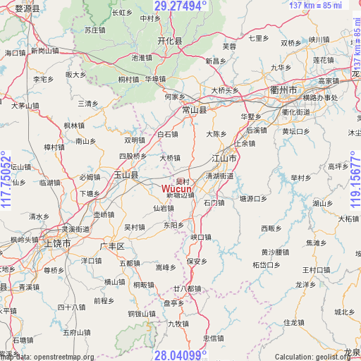
Wucun GPS coordinates[2]
28° 39' 35.208" North, 118° 27' 13.104" East
| Map corner | latitude | longitude |
|---|---|---|
| Upper-left | 29.27494°, | 117.75052° |
| Center: | 28.65978°, | 118.45364° |
| Lower-right: | 28.04099°, | 119.15677° |
| Map W x H: | 137.2×137.2 km | = 85.3×85.3mi |
| max Lat: | 53.31946° ⇑68.4% North |
| Wucun: | 28.65978° |
| min Lat: | ⇓31.6% South 18.22056° |
| min Long | Wucun | max Long |
| 75.07348° | 118.45364° | 134.28917° |
| W 72.9%⇐ | ⇒27.1% E |
Elevation
Elevation of Wucun is 168 m = 551 ft, and this is 316.8 m = 1039 ft below average elevation for this country.
| Max E: |
5622 m = 18445 ft | 49.6% |
| Avg. | 484.8 m = 1591 ft | |
| Wucun | 168 m = 551 ft | |
Min E: |
-3 m = -10 ft | 50.4% |
See also: China elevation on elevation.city.
Geographical zone
Wucun is located in North temperate zone (between Tropic of Cancer and the Arctic Circle). Distance of this Northern Tropic circle is 580.7 km =360.8 mi to South.| Distance of | km | miles | from Wucun |
|---|---|---|---|
| North Pole | 6820.4 | 4238 | to North |
| Arctic Circle | 4214.5 | 2618.8 | to North |
| Tropic Cancer | 580.7 | 360.8 | to South |
| Equator | 3186.7 | 1980.1 | to South |


Nearby cities:
15 places around Wucun: (largest is in red/bold)
• Baishijie
18.8 km =11.7 mi,  344°
344°
• Baiyun
16.5 km =10.3 mi,  311°
311°
• Daqiao
10.4 km =6.5 mi,  333°
333°
• Fenglin
15.9 km =9.9 mi,  163°
163°
• Guancun
20.6 km =12.8 mi,  187°
187°
• Hecun
7.4 km =4.6 mi,  80°
80°
• Huacun
17.5 km =10.9 mi,  242°
242°
• Liudu
14.6 km =9.1 mi,  264°
264°
• Maofan
13.3 km =8.3 mi,  166°
166°
• Tanshi
7.3 km =4.5 mi,  32°
32°
• Xianyan
11.2 km =7 mi,  211°
211°
• Xiazhen
5.2 km =3.2 mi,  253°
253°
• Xintangbian
4.2 km =2.6 mi,  182°
182°
• Yanrui
12.9 km =8 mi,  297°
297°
• Yutou
6.6 km =4.1 mi,  129°
129°
Sources, notices
• [Note1] Compared only with cities in China existing in our database
• [Src1] Map data: © OpenStreetMap contributors (CC-BY-SA)
• [Src2] Other city data from geonames.org with taken over terms of usage.
• [Src3] Geographical zone / Annual Mean Temperature by Robert A. Rohde @ Wikipedia
