Shangrao geodata
Shangrao (Guangdong) is a seat of a fourth-order administrative division; located in China in Asia/Shanghai (GMT+8) time zone. In our database, there are 1268 cities with bigger population. Compared to other cities in China, 89.9% of cities are located further ↑North; 65.5% of cities are located further ←West and 52.2% of cities have higher elevation than Shangrao. Note1


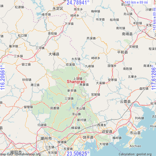
Shangrao GPS coordinates[2]
24° 8' 57.984" North, 116° 54' 35.028" East
| Map corner | latitude | longitude |
|---|---|---|
| Upper-left | 24.78941°, | 116.20661° |
| Center: | 24.14944°, | 116.90973° |
| Lower-right: | 23.50625°, | 117.61286° |
| Map W x H: | 142.7×142.7 km | = 88.7×88.7mi |
| max Lat: | 53.31946° ⇑89.9% North |
| Shangrao: | 24.14944° |
| min Lat: | ⇓10.1% South 18.22056° |
| min Long | Shangrao | max Long |
| 75.07348° | 116.90973° | 134.28917° |
| W 65.5%⇐ | ⇒34.5% E |
Elevation
Elevation of Shangrao is 148 m = 486 ft, and this is 336.8 m = 1105 ft below average elevation for this country.
| Max E: |
5622 m = 18445 ft | 52.2% |
| Avg. | 484.8 m = 1591 ft | |
| Shangrao | 148 m = 486 ft | |
Min E: |
-3 m = -10 ft | 47.8% |
See also: China elevation on elevation.city.
Geographical zone
Shangrao is located in North temperate zone (between Tropic of Cancer and the Arctic Circle). Distance of this Northern Tropic circle is 79.2 km =49.2 mi to South.| Distance of | km | miles | from Shangrao |
|---|---|---|---|
| North Pole | 7321.9 | 4549.6 | to North |
| Arctic Circle | 4716 | 2930.4 | to North |
| Tropic Cancer | 79.2 | 49.2 | to South |
| Equator | 2685.2 | 1668.5 | to South |


Nearby cities:
15 places around Shangrao: (largest is in red/bold)
• Baihou
22.4 km =13.9 mi,  319°
319°
• Changle
16.4 km =10.2 mi,  9°
9°
• Dadong
18.1 km =11.2 mi,  353°
353°
• Fenglang
16.5 km =10.3 mi, 318°
• Guangde
18 km =11.2 mi,  268°
268°
• Jianrao
14.5 km =9 mi,  180°
180°
• Pingyuan
21.1 km =13.1 mi,  289°
289°
• Raoyang
6.4 km =4 mi,  212°
212°
• Sanrao
20.3 km =12.6 mi, 205°
• Shuangxi
14.7 km =9.1 mi,  330°
330°
• Xiage
20.2 km =12.6 mi,  149°
149°
• Xinfeng
12.2 km =7.6 mi, 206°
• Xintang
26.6 km =16.5 mi, 210°
• Xiufeng
21.4 km =13.3 mi,  20°
20°
• Xiuzhuan
7.5 km =4.7 mi,  132°
132°
Sources, notices
• [Note1] Compared only with cities in China existing in our database
• [Src1] Map data: © OpenStreetMap contributors (CC-BY-SA)
• [Src2] Other city data from geonames.org with taken over terms of usage.
• [Src3] Geographical zone / Annual Mean Temperature by Robert A. Rohde @ Wikipedia
