Nandiantou geodata
Nandiantou (Hebei) is a seat of a fourth-order administrative division; located in China in Asia/Shanghai (GMT+8) time zone. In our database, there are 1268 cities with bigger population. Compared to other cities in China, 82.2% of cities are located further ↓South; 53.7% of cities are located further ←West and 60.8% of cities have higher elevation than Nandiantou. Note1


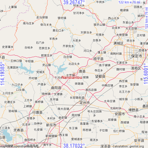
Nandiantou GPS coordinates[2]
38° 43' 15.6" North, 114° 53' 49.092" East
| Map corner | latitude | longitude |
|---|---|---|
| Upper-left | 39.26747°, | 114.19385° |
| Center: | 38.721°, | 114.89697° |
| Lower-right: | 38.17032°, | 115.6001° |
| Map W x H: | 122×122 km | = 75.8×75.8mi |
| max Lat: | 53.31946° ⇑17.8% North |
| Nandiantou: | 38.721° |
| min Lat: | ⇓82.2% South 18.22056° |
| min Long | Nandiantou | max Long |
| 75.07348° | 114.89697° | 134.28917° |
| W 53.7%⇐ | ⇒46.3% E |
Elevation
Elevation of Nandiantou is 94 m = 308 ft, and this is 390.8 m = 1282 ft below average elevation for this country.
| Max E: |
5622 m = 18445 ft | 60.8% |
| Avg. | 484.8 m = 1591 ft | |
| Nandiantou | 94 m = 308 ft | |
Min E: |
-3 m = -10 ft | 39.2% |
See also: China elevation on elevation.city.
Geographical zone
Nandiantou is located in North temperate zone (between Tropic of Cancer and the Arctic Circle). Distance of this Northern Tropic circle is 1699.5 km =1056 mi to South.| Distance of | km | miles | from Nandiantou |
|---|---|---|---|
| North Pole | 5701.7 | 3542.9 | to North |
| Arctic Circle | 3095.8 | 1923.6 | to North |
| Tropic Cancer | 1699.5 | 1056 | to South |
| Equator | 4305.4 | 2675.3 | to South |


Nearby cities:
15 places around Nandiantou: (largest is in red/bold)
• Baihe
15.6 km =9.7 mi,  339°
339°
• Baoshui
6 km =3.7 mi,  270°
270°
• Beidiantou
8.5 km =5.3 mi,  357°
357°
• Beiluo
3.6 km =2.2 mi,  244°
244°
• Changgucheng
6.1 km =3.8 mi,  107°
107°
• Dayang
10.5 km =6.5 mi,  301°
301°
• Dongwang
15.5 km =9.6 mi,  195°
195°
• Duting
3.5 km =2.2 mi,  71°
71°
• Luozhuang
9.7 km =6 mi,  256°
256°
• Micheng
19.2 km =11.9 mi,  325°
325°
• Pangcun
13.3 km =8.3 mi,  152°
152°
• Xiahe
13.3 km =8.3 mi, 259°
• Zhaocun
18.3 km =11.4 mi,  176°
176°
• Zhuangke
17.9 km =11.1 mi, 260°
• Zhuanlu
8.4 km =5.2 mi, 150°
Sources, notices
• [Note1] Compared only with cities in China existing in our database
• [Src1] Map data: © OpenStreetMap contributors (CC-BY-SA)
• [Src2] Other city data from geonames.org with taken over terms of usage.
• [Src3] Geographical zone / Annual Mean Temperature by Robert A. Rohde @ Wikipedia
