Hangbu geodata
Hangbu (Jiangxi) is a seat of a fourth-order administrative division; located in China in Asia/Shanghai (GMT+8) time zone. In our database, there are 1268 cities with bigger population. Compared to other cities in China, 75.1% of cities are located further ↑North; 61.4% of cities are located further ←West and 69.7% of cities have higher elevation than Hangbu. Note1


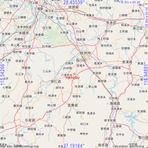
Hangbu GPS coordinates[2]
27° 48' 55.08" North, 116° 14' 44.808" East
| Map corner | latitude | longitude |
|---|---|---|
| Upper-left | 28.43539°, | 115.54266° |
| Center: | 27.8153°, | 116.24578° |
| Lower-right: | 27.19164°, | 116.94891° |
| Map W x H: | 138.3×138.3 km | = 85.9×85.9mi |
| max Lat: | 53.31946° ⇑75.1% North |
| Hangbu: | 27.8153° |
| min Lat: | ⇓24.9% South 18.22056° |
| min Long | Hangbu | max Long |
| 75.07348° | 116.24578° | 134.28917° |
| W 61.4%⇐ | ⇒38.6% E |
Elevation
Elevation of Hangbu is 53 m = 174 ft, and this is 431.8 m = 1417 ft below average elevation for this country.
| Max E: |
5622 m = 18445 ft | 69.7% |
| Avg. | 484.8 m = 1591 ft | |
| Hangbu | 53 m = 174 ft | |
Min E: |
-3 m = -10 ft | 30.3% |
See also: China elevation on elevation.city.
Geographical zone
Hangbu is located in North temperate zone (between Tropic of Cancer and the Arctic Circle). Distance of this Northern Tropic circle is 486.9 km =302.5 mi to South.| Distance of | km | miles | from Hangbu |
|---|---|---|---|
| North Pole | 6914.3 | 4296.3 | to North |
| Arctic Circle | 4308.4 | 2677.1 | to North |
| Tropic Cancer | 486.9 | 302.5 | to South |
| Equator | 3092.8 | 1921.8 | to South |


Nearby cities:
15 places around Hangbu: (largest is in red/bold)
• Bailu
11.5 km =7.1 mi,  336°
336°
• Bashan
19.9 km =12.4 mi,  254°
254°
• Chonggang
16.5 km =10.3 mi,  49°
49°
• Gaoping
15.3 km =9.5 mi,  324°
324°
• Guoxu
18.1 km =11.2 mi,  226°
226°
• Hebu
15.3 km =9.5 mi,  101°
101°
• Liancheng
10.5 km =6.5 mi,  35°
35°
• Liujiaqiao
7.1 km =4.4 mi,  264°
264°
• Longxi
12 km =7.5 mi,  159°
159°
• Qiuxi
4.5 km =2.8 mi,  34°
34°
• Shangdundu
14.4 km =8.9 mi,  18°
18°
• Sunfang
8.7 km =5.4 mi,  313°
313°
• Taobei
20.5 km =12.7 mi,  173°
173°
• Wenquan
16.6 km =10.3 mi,  2°
2°
• Xufang
18.2 km =11.3 mi,  188°
188°
Sources, notices
• [Note1] Compared only with cities in China existing in our database
• [Src1] Map data: © OpenStreetMap contributors (CC-BY-SA)
• [Src2] Other city data from geonames.org with taken over terms of usage.
• [Src3] Geographical zone / Annual Mean Temperature by Robert A. Rohde @ Wikipedia
